
Map Image
Del resumen del conjunto de datos
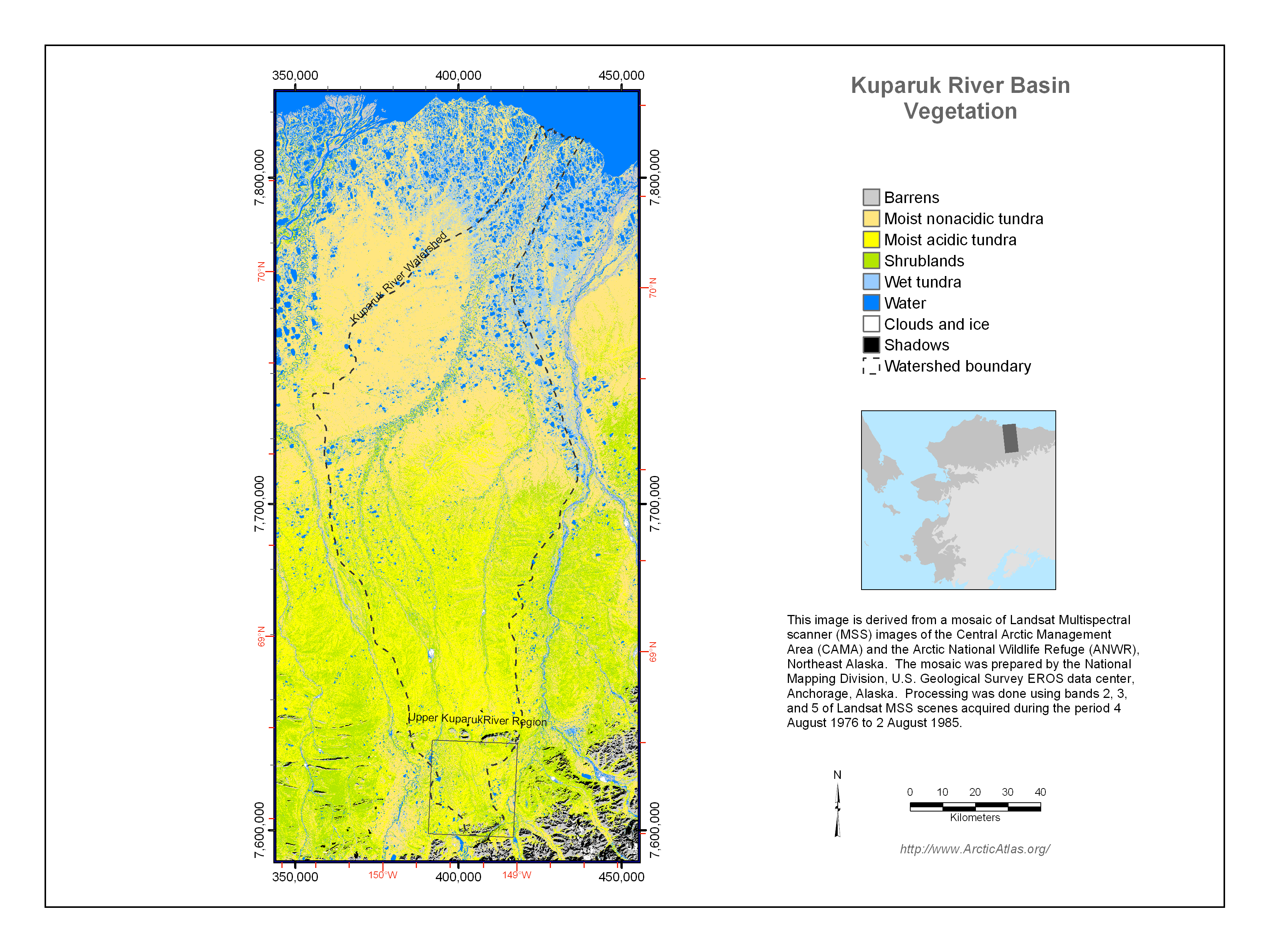
The vegetation of the Kuparuk River watershed was mapped for several US National Science Foundation projects, including the Arctic System Science Flux Study and the Long-Term Ecological...
Fuente: Kuparuk River Basin Vegetation Map (Muller et al. 1998)
Información adicional
| Campo | Valor |
|---|---|
| Última actualización de los datos | Diciembre 17, 2019 |
| Última actualización de los metadatos | Diciembre 17, 2019 |
| Creado | Diciembre 17, 2019 |
| Formato | image/png |
| Licencia | No se ha proporcionado una licencia |
| created | hace 6 años |
| format | PNG |
| has views | True |
| id | 7369e652-005e-480d-8b20-8da2c9da7188 |
| last modified | hace 6 años |
| mimetype | image/png |
| on same domain | True |
| package id | dca96ea1-f56f-41ad-8156-a76791670da8 |
| position | 4 |
| revision id | 375b40eb-8829-400a-8ab8-2c6eda102e47 |
| size | 1,1 MiB |
| state | active |
| url type | upload |