
Map Preview
Datu multzoaren laburpenarena
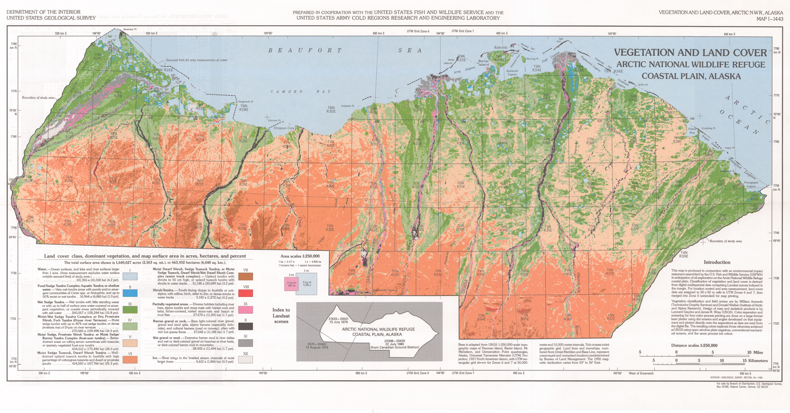
The Landsat-assisted environmental mapping of the northern coastal plain of the Arctic National Wildlife Refuge, Alaska was funded by the US Fish and Wildlife Service and the US...
Iturria: Land cover map of the Arctic National Wildlife Refuge (Walker et al. 1982)
Informazio gehigarria
| Eremua | Balorea |
|---|---|
| Datuen azken eguneratzea | Abendua 17, 2019 |
| Metadatuen azken eguneratzea | Abendua 17, 2019 |
| Sortuta | Abendua 17, 2019 |
| Formatua | image/png |
| Lizentzia | License not specified |
| created | duela 6 urte |
| format | PNG |
| has views | True |
| id | 667a9f8d-e0d1-43e8-9a1b-d2875ded4bbb |
| last modified | duela 6 urte |
| mimetype | image/png |
| on same domain | True |
| package id | e64e3800-0cf9-416f-87ef-d1319007b848 |
| revision id | 7487a556-4ea4-47c9-b28d-9f2848ce2a91 |
| size | 2,1 MiB |
| state | active |
| url type | upload |