
Map Image
Datu multzoaren laburpenarena
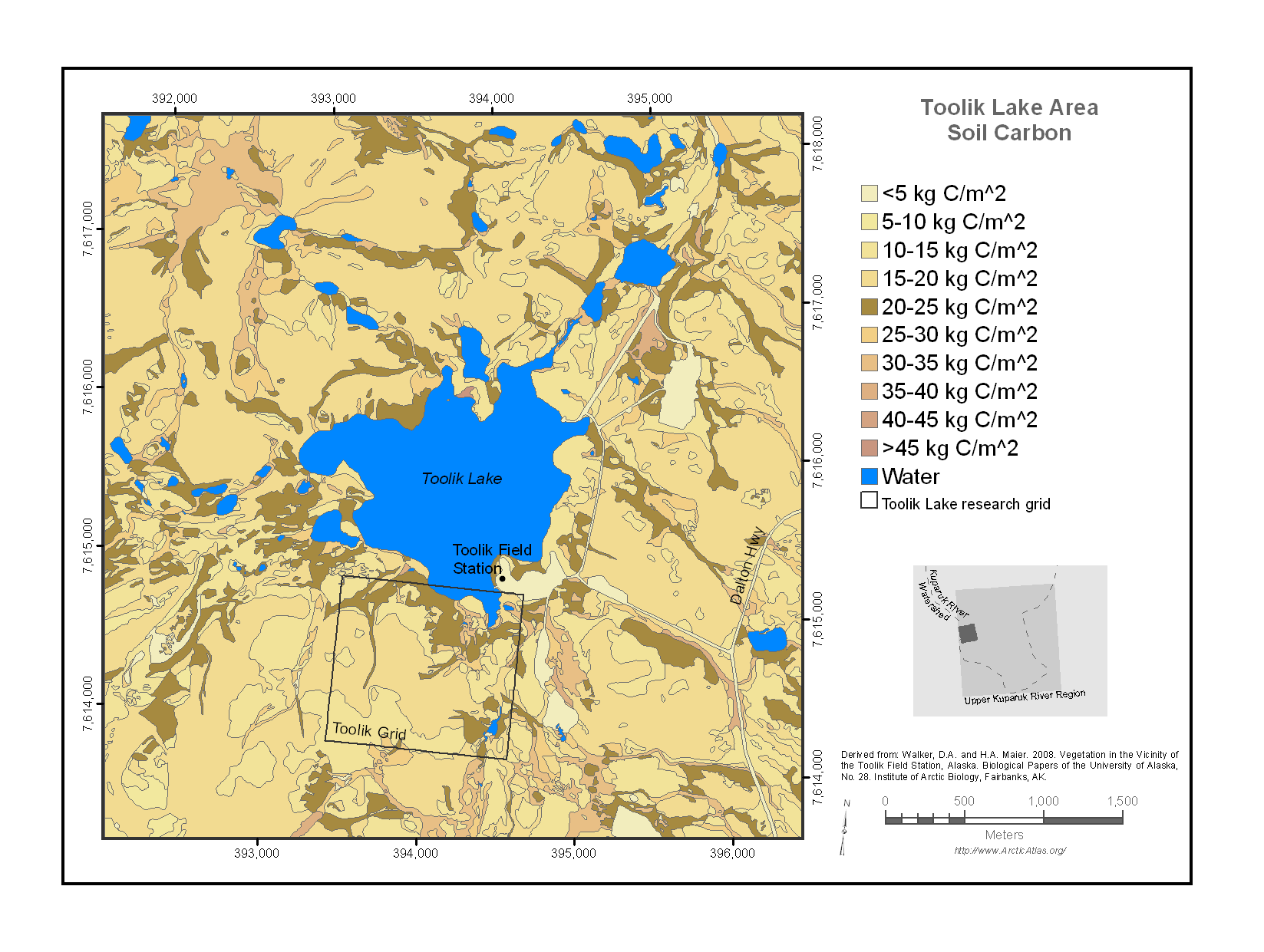
Map of the Toolik Lake research area soil carbon. The map encloses a 20 km^2 area surrounding Toolik Lake that stretches from the Dalton Highway on the east to Jade Mountain on the west....
Iturria: Toolik Lake Area Soil Carbon
Informazio gehigarria
| Eremua | Balorea |
|---|---|
| Datuen azken eguneratzea | Abendua 17, 2019 |
| Metadatuen azken eguneratzea | Abendua 17, 2019 |
| Sortuta | Abendua 17, 2019 |
| Formatua | image/png |
| Lizentzia | Ez da lizentzia batez hornitu |
| created | duela 6 urte |
| format | PNG |
| has views | True |
| id | bafc99a5-f682-4e32-a308-1809d4bc2e20 |
| last modified | duela 6 urte |
| mimetype | image/png |
| on same domain | True |
| package id | 5ba48a4c-c5ab-4c98-b33e-a1faff594fa1 |
| position | 1 |
| revision id | 2e928356-ae30-496a-82c1-9fbe66fea2a3 |
| size | 174,4 KiB |
| state | active |
| url type | upload |