
Map Image
Datu multzoaren laburpenarena
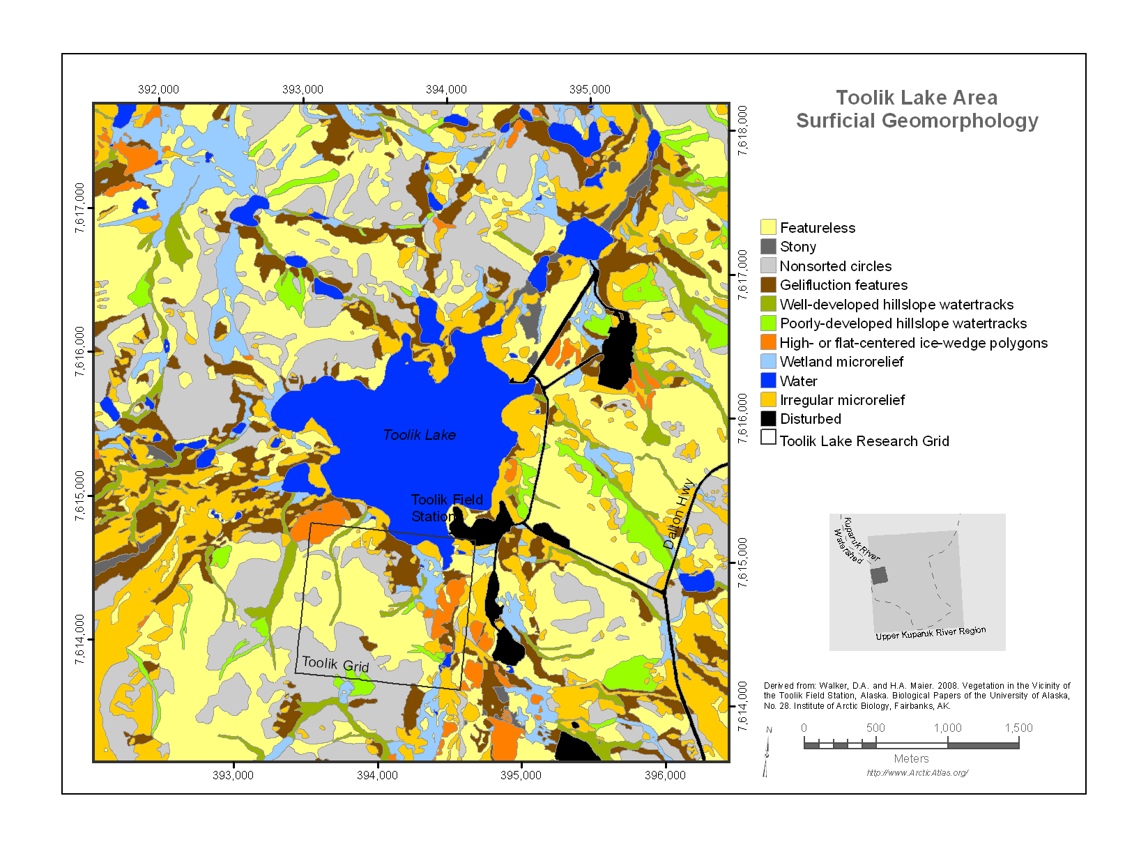
Map of the Toolik Lake research area surficial geomorphology . The Toolik Lake area map is near the western boundary of the Upper Kuparuk River region map and encloses a 20-km^2 area...
Informazio gehigarria
| Eremua | Balorea |
|---|---|
| Datuen azken eguneratzea | Abendua 17, 2019 |
| Metadatuen azken eguneratzea | Abendua 17, 2019 |
| Sortuta | Abendua 17, 2019 |
| Formatua | image/png |
| Lizentzia | Ez da lizentzia batez hornitu |
| created | duela 6 urte |
| format | PNG |
| has views | True |
| id | 350ec13f-b0cf-44d4-b6f1-9c9c402080ff |
| last modified | duela 6 urte |
| mimetype | image/png |
| on same domain | True |
| package id | f7d05285-b755-4d04-b3df-0d09b51e6e54 |
| position | 1 |
| revision id | c15050d2-1159-459b-be8d-2c8f7820e885 |
| size | 179,8 KiB |
| state | active |
| url type | upload |