
Shore
Tietoaineiston yhteenvedosta
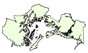
Shoreline for the Chugach National Forest was digitized from 1:63,360 Primary Base Series (PBS) quads by the USFS Geometronics Service Center (GSC) in Salt Lake City. Data available from...
Lähde: Chugach National Forest GIS – Saltwater Shoreline Polygons
Lisätietoa
| Kenttä | Arvo |
|---|---|
| Data viimeksi päivitetty | 17. joulukuu, 2019 |
| Metatieto viimeksi päivitetty | 17. joulukuu, 2019 |
| Luotu | 17. joulukuu, 2019 |
| Muoto | image/gif |
| Lisenssi | Ei lisenssiä |
| created | yli 5 vuotta sitten |
| format | GIF |
| has views | True |
| id | ca5c7db0-c9fd-478b-88b5-ee957715ec4c |
| last modified | yli 5 vuotta sitten |
| mimetype | image/gif |
| on same domain | True |
| package id | 3882b807-828b-4bdc-9fcf-58f5d7ab044f |
| position | 1 |
| revision id | e7a5bd74-17d7-469e-a68a-89c1b268283c |
| size | 3,1 KiB |
| state | active |
| url type | upload |