
aga_prudhoe_b_change_2010.jpg
Issu du résumé du jeu de données
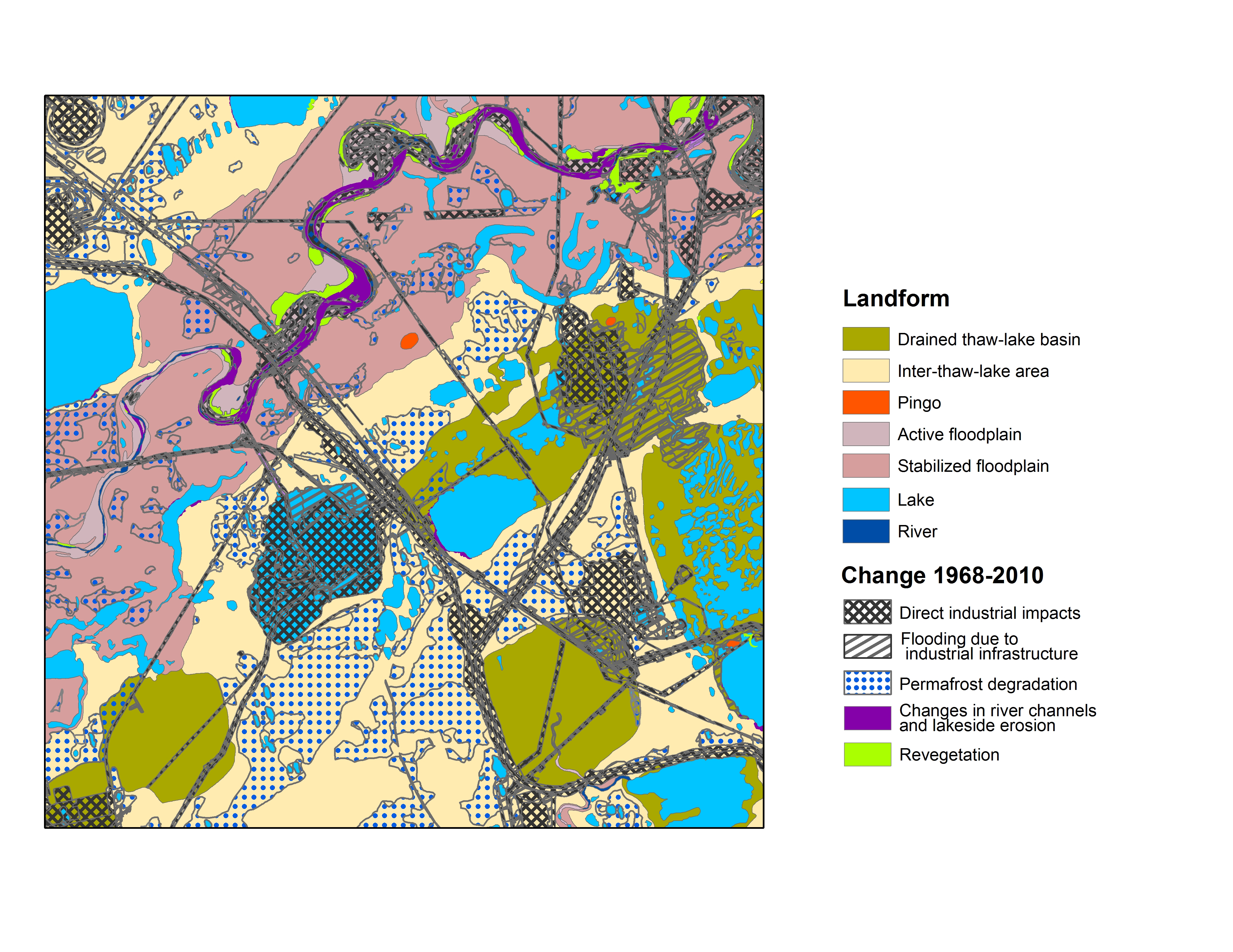
Map B of the historical infrastructure changes for the Prudhoe Bay Oilfield for 10 dates from the initial oil discovery in 1968–2011. Aerial photos taken in 1949 and 1968 were used to...
Informations additionnelles
| Champ | Valeur |
|---|---|
| Dernière modification de la donnée | 17 Décembre 2019 |
| Dernière modification de la métadonnée | 17 Décembre 2019 |
| Créé le | 17 Décembre 2019 |
| Format | image/jpeg |
| Licence | Aucune licence fournie |
| created | Il y a plus de 6 ans |
| format | JPEG |
| has views | True |
| id | afb78480-d1cd-49bd-9c88-8da56e561203 |
| last modified | Il y a plus de 6 ans |
| mimetype | image/jpeg |
| on same domain | True |
| package id | 0aa5a30f-cfb7-4401-9284-636f5c1e824c |
| position | 1 |
| revision id | e29b62b2-1d5e-4cee-b00c-c71342856fdb |
| size | 5,6 mébi |
| state | active |
| url type | upload |