
Map Image
מתוך תקציר צביר הנתונים
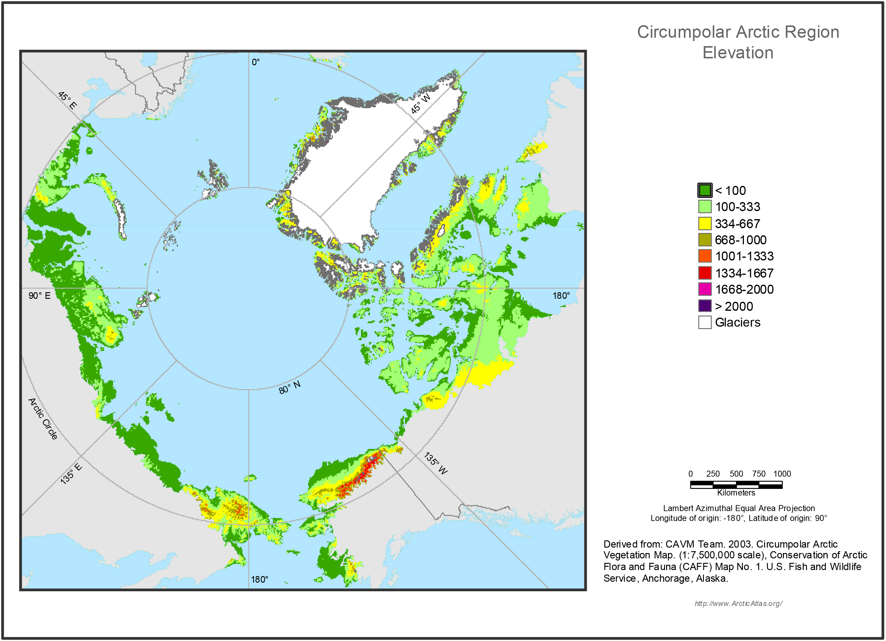
Elevation strongly influences soil moisture and patterns of tundra plant communities. Areas less than 100 m above sea level were separated to show low-elevation plains. Areas above 100 m...
מידע נוסף
| שדה | ערך |
|---|---|
| עדכון הנתונים האחרון | 17 דצמבר, 2019 |
| עדכון אחרון של נתוני העל | 17 דצמבר, 2019 |
| נוצר ב | 17 דצמבר, 2019 |
| מבנה (Format) | image/jpeg |
| רישיון | לא סופק רישיון |
| created | לפני יותר מ-5 שנים |
| format | JPEG |
| has views | True |
| id | bc995cc5-b00a-454e-bc84-12077b726f72 |
| last modified | לפני יותר מ-5 שנים |
| mimetype | image/jpeg |
| on same domain | True |
| package id | 09ec8ead-9d7d-4bf2-ae81-e21cd555f356 |
| position | 3 |
| revision id | 32c3e28c-935b-4020-af0d-817b2cf681f3 |
| size | 1.7 MiB |
| state | active |
| url type | upload |