
Map Preview
מתוך תקציר צביר הנתונים
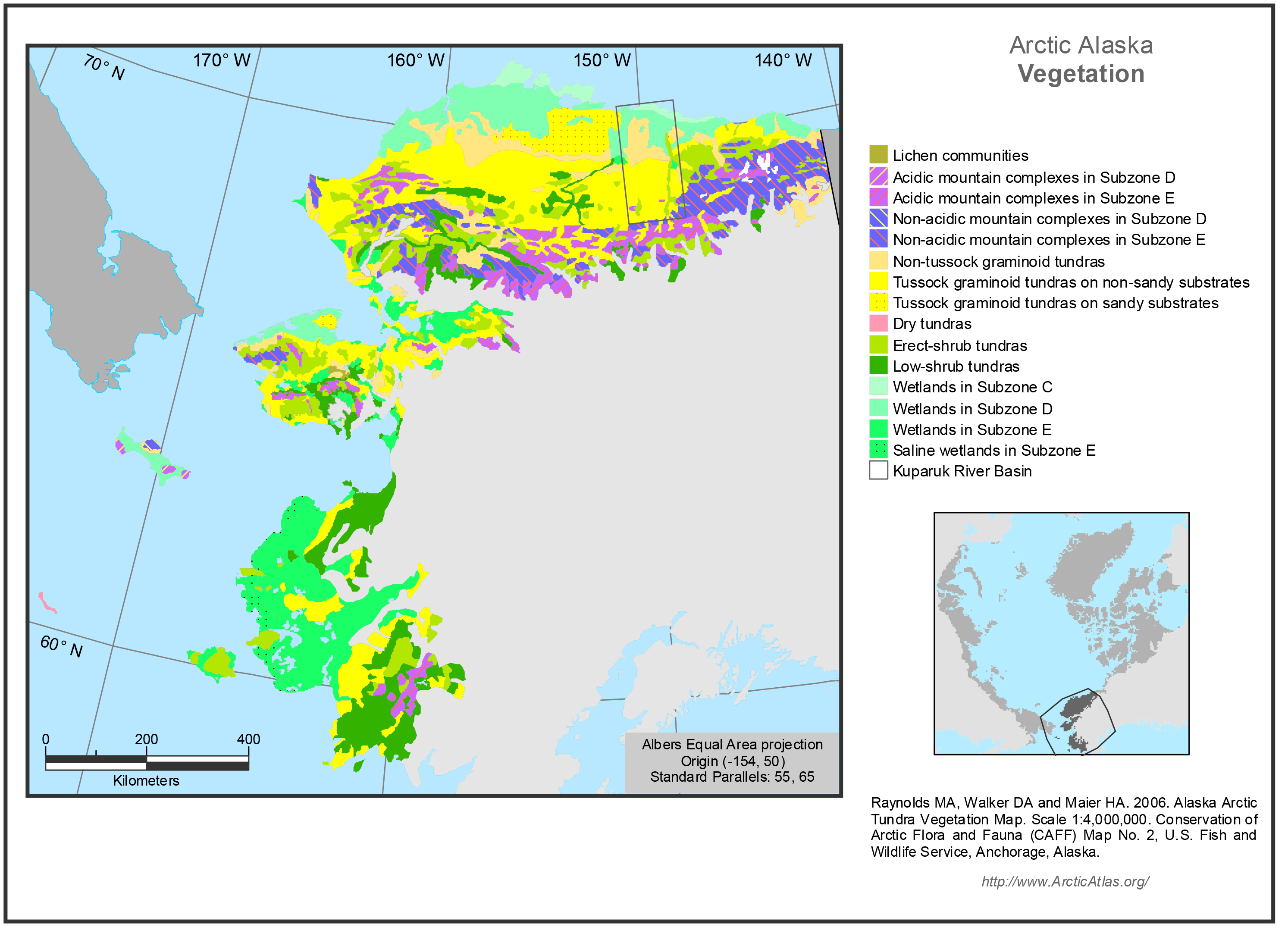
Mapped polygons at 1:7.5 million scale contain many vegetation types. The map portrays the zonal vegetation within each mapped polygon. Zonal sites are areas where the vegetation develops...
מידע נוסף
| שדה | ערך |
|---|---|
| עדכון הנתונים האחרון | 17 דצמבר, 2019 |
| עדכון אחרון של נתוני העל | 17 דצמבר, 2019 |
| נוצר ב | 17 דצמבר, 2019 |
| מבנה (Format) | image/jpeg |
| רישיון | לא סופק רישיון |
| created | לפני יותר מ-5 שנים |
| format | JPEG |
| has views | True |
| id | 1bbd1e39-9e6d-4700-bb2c-222acbad6f33 |
| last modified | לפני יותר מ-5 שנים |
| mimetype | image/jpeg |
| on same domain | True |
| package id | c7322eec-9486-48a2-a6f8-c0dcaeb76de4 |
| position | 2 |
| revision id | 15cf964c-d9cc-4fe5-8de5-a51f66d225d7 |
| size | 1.9 MiB |
| state | active |
| url type | upload |