
Map Image
מתוך תקציר צביר הנתונים
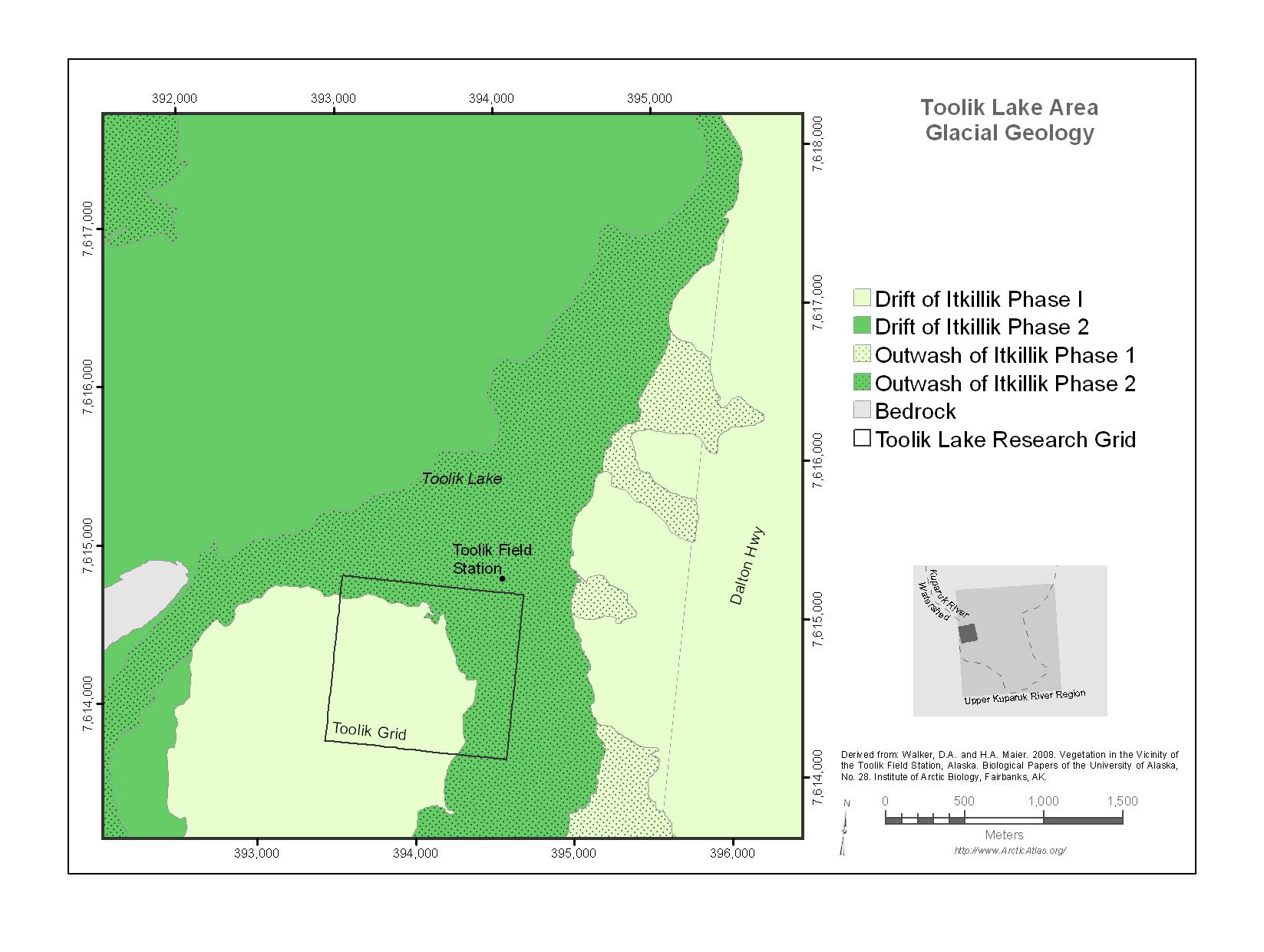
The map encloses a 20 km^2 area surrounding Toolik Lake that stretches from the Dalton Highway on the east to Jade Mountain on the west. It includes the Toolik Field Station, the old...
מידע נוסף
| שדה | ערך |
|---|---|
| עדכון הנתונים האחרון | 17 דצמבר, 2019 |
| עדכון אחרון של נתוני העל | 17 דצמבר, 2019 |
| נוצר ב | 17 דצמבר, 2019 |
| מבנה (Format) | image/png |
| רישיון | לא סופק רישיון |
| created | לפני יותר מ-5 שנים |
| format | PNG |
| has views | True |
| id | 034cb03e-e17a-4de7-be1e-1a8ae35cd453 |
| last modified | לפני יותר מ-5 שנים |
| mimetype | image/png |
| on same domain | True |
| package id | 64a24459-6fd1-4353-9288-eb076e171f91 |
| position | 1 |
| revision id | e00e7883-a130-41b8-ae44-b1acb49a5db8 |
| size | 86 KiB |
| state | active |
| url type | upload |