
aga_toolik_grid_surfgeom_walker_2008.png
מתוך תקציר צביר הנתונים
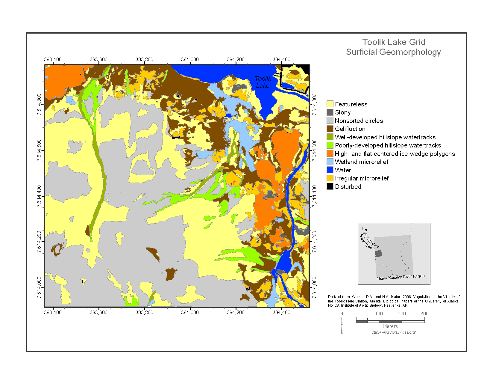
The Toolik Lake Grid map focuses on the south side of Toolik Lake. This area is one of the principal intensive research areas at the Toolik Lake Field Station. It includes many...
מידע נוסף
| שדה | ערך |
|---|---|
| עדכון הנתונים האחרון | 17 דצמבר, 2019 |
| עדכון אחרון של נתוני העל | 17 דצמבר, 2019 |
| נוצר ב | 17 דצמבר, 2019 |
| מבנה (Format) | image/png |
| רישיון | לא סופק רישיון |
| created | לפני יותר מ-5 שנים |
| format | PNG |
| has views | True |
| id | e6f31cdf-2a3c-4206-9fa2-196f42334258 |
| last modified | לפני יותר מ-5 שנים |
| mimetype | image/png |
| on same domain | True |
| package id | 1bef10a3-d020-43f9-a7b4-2fa2bac3096c |
| position | 1 |
| revision id | 8d85f9a9-099e-4c39-9a0f-9272552d4ce1 |
| size | 118.7 KiB |
| state | active |
| url type | upload |