
Screen Shot 2017-09-22 at 12.31.29 PM.jpg
Dal riassunto del dataset
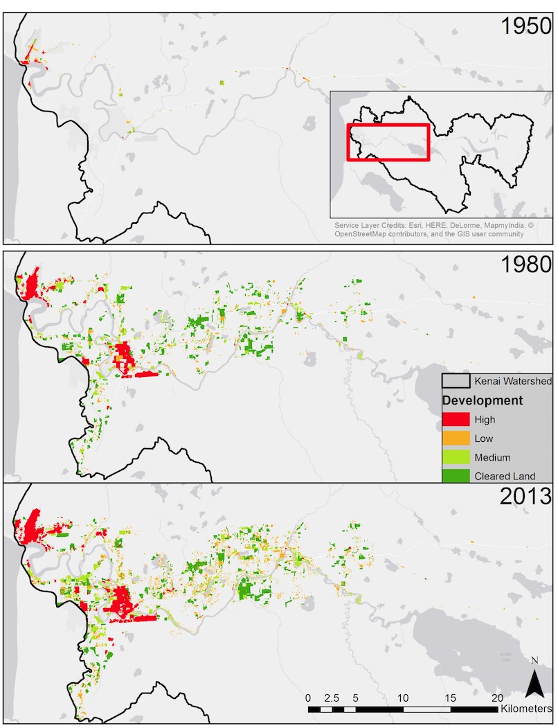
The expanding footprint of human development in the lower Kenai River watershed based on analysis of aerial photographs. Inset in top panel shows location within entire Kenai River...
Sorgente: Human Development in the Lower Kenai River Watershed, 1950-2013 - Interactive Slider Graphic
Informazioni supplementari
| Campo | Valore |
|---|---|
| Data last updated | Dicembre 17, 2019 |
| Metadata last updated | Dicembre 17, 2019 |
| Creato | Dicembre 17, 2019 |
| Formato | image/jpeg |
| Licenza | License not specified |
| created | più di 6 anni fa |
| format | JPEG |
| has views | True |
| id | a412456e-096c-4433-8020-e05af3daf4c2 |
| last modified | più di 6 anni fa |
| mimetype | image/jpeg |
| on same domain | True |
| package id | 1786f5d9-d5bb-4f27-b480-f42595b6e6ed |
| position | 1 |
| revision id | e7a25e1c-825f-4b29-9099-d41d8c142a57 |
| size | 175,4 KiB |
| state | active |
| url type | upload |