
Map Image
Dal riassunto del dataset
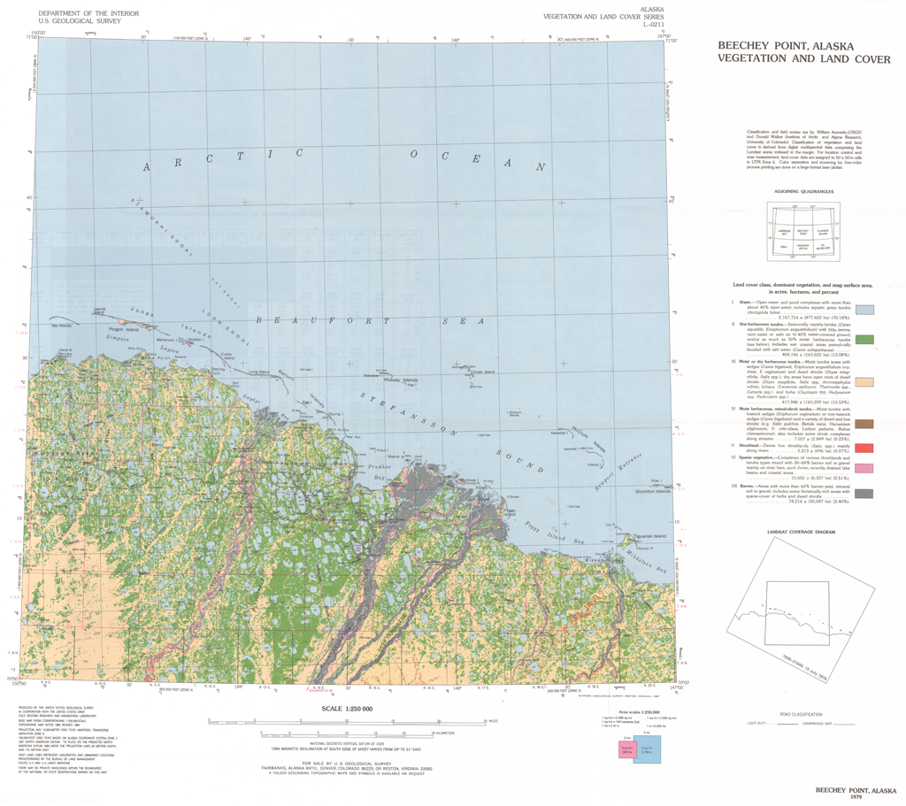
This report presents a Landsat-derived land cover classification of the Beechey Point, Alaska, 1:250,000-scale quadrangle with descriptions of the major vegetation units. Eight...
Sorgente: Beechey Point Land Cover Classification: CRREL Report 87-5
Informazioni supplementari
| Campo | Valore |
|---|---|
| Data last updated | Dicembre 17, 2019 |
| Metadata last updated | Dicembre 17, 2019 |
| Creato | Dicembre 17, 2019 |
| Formato | image/png |
| Licenza | Nessuna licenza indicata |
| created | più di 6 anni fa |
| format | PNG |
| has views | True |
| id | 9e57a197-a373-4bd7-adfb-8a04447a99c9 |
| last modified | più di 6 anni fa |
| mimetype | image/png |
| on same domain | True |
| package id | 98fcb47a-8a78-45e3-8f27-c6a907441759 |
| position | 4 |
| revision id | e62b8497-878d-4cdc-9271-50600db339fb |
| size | 1,1 MiB |
| state | active |
| url type | upload |