
aga_prudhoe_geobotancal_2014.jpg
Dal riassunto del dataset
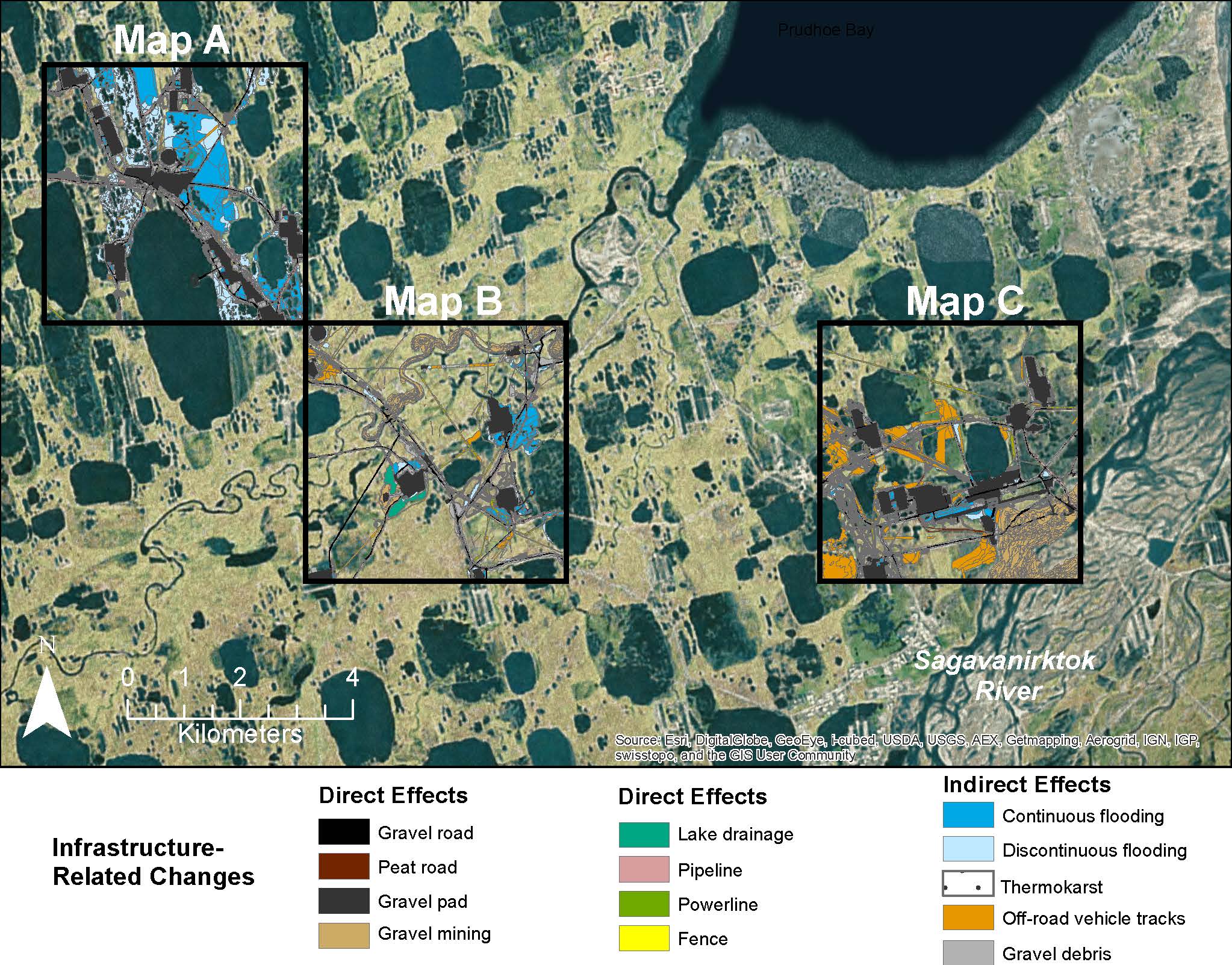
Map C of the historical infrastructure changes for the Prudhoe Bay Oilfield for 10 dates from the initial oil discovery in 1968–2011. Aerial photos taken in 1949 and 1968 were used to...
Sorgente: Prudhoe Bay Cumulative Impact Map C: Raynolds 2014
Informazioni supplementari
| Campo | Valore |
|---|---|
| Data last updated | Dicembre 17, 2019 |
| Metadata last updated | Dicembre 17, 2019 |
| Creato | Dicembre 17, 2019 |
| Formato | image/jpeg |
| Licenza | Nessuna licenza indicata |
| created | più di 6 anni fa |
| format | JPEG |
| has views | True |
| id | a85c5920-51ae-4ddb-b7e5-8e2955ab07ff |
| last modified | più di 6 anni fa |
| mimetype | image/jpeg |
| on same domain | True |
| package id | 14121b28-77df-4681-ab96-884a55fb2daf |
| position | 4 |
| revision id | e826514e-26f7-4b83-a7c4-6173d1e6677e |
| size | 429,5 KiB |
| state | active |
| url type | upload |