
Map Image
Dal riassunto del dataset
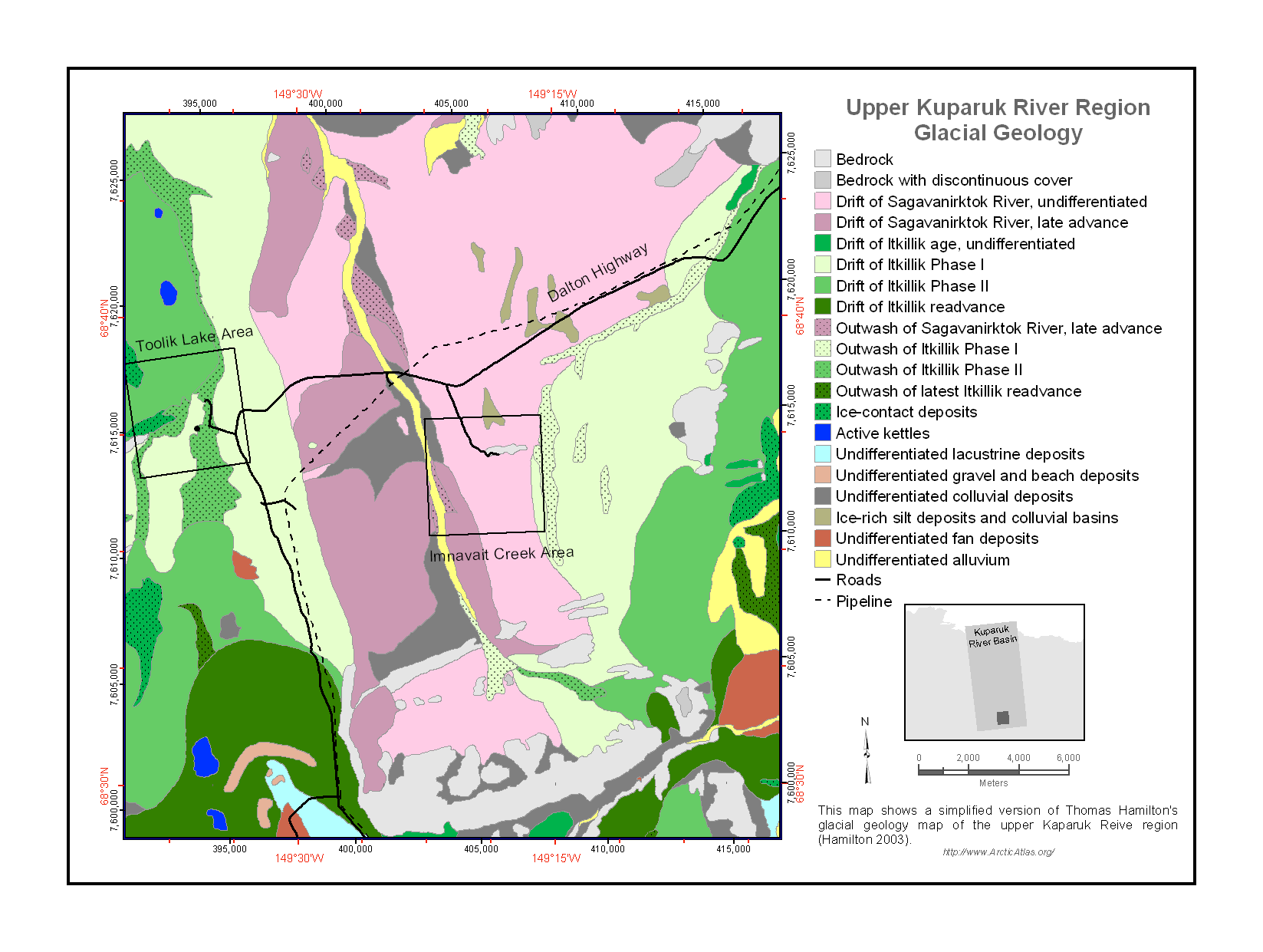
This vector (shp) map is a simplified version (1:25000) of Thomas Hamilton's glacial geology map of the Upper Kuparuk River region (Hamilton 2003), which provides detailed...
Sorgente: Upper Kuparuk Glacial Geology
Informazioni supplementari
| Campo | Valore |
|---|---|
| Data last updated | Dicembre 17, 2019 |
| Metadata last updated | Dicembre 17, 2019 |
| Creato | Dicembre 17, 2019 |
| Formato | image/png |
| Licenza | Nessuna licenza indicata |
| created | più di 6 anni fa |
| format | PNG |
| has views | True |
| id | 3941d672-daba-4095-adeb-798a7a5824bb |
| last modified | più di 6 anni fa |
| mimetype | image/png |
| on same domain | True |
| package id | 44fda17a-5de5-4894-8b01-b788a2a89867 |
| position | 2 |
| revision id | b447377b-1eff-467a-a8fa-cced70c7d614 |
| size | 137,5 KiB |
| state | active |
| url type | upload |