
Screen Shot 2017-09-22 at 12.31.29 PM.jpg
データセットの概要より
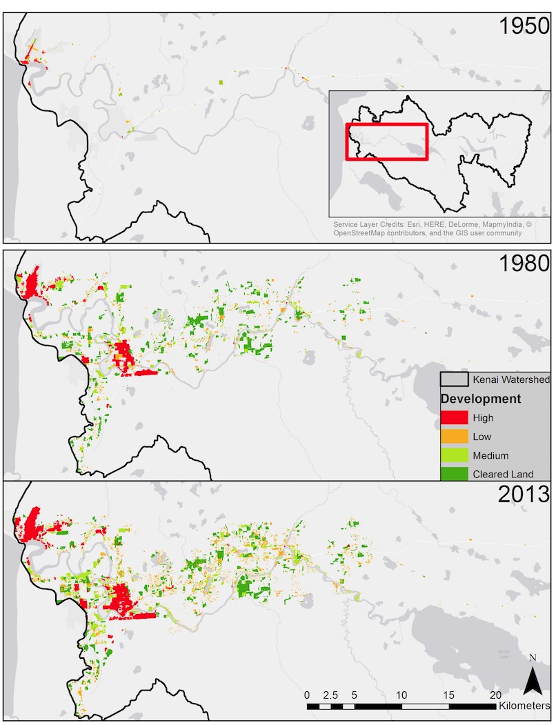
The expanding footprint of human development in the lower Kenai River watershed based on analysis of aerial photographs. Inset in top panel shows location within entire Kenai River...
Source: Human Development in the Lower Kenai River Watershed, 1950-2013 - Interactive Slider Graphic
追加情報
| フィールド | 値 |
|---|---|
| 最終更新日 | 2019 / 12月 / 17, |
| メタデータ最終更新日時 | 2019 / 12月 / 17, |
| 作成日 | 2019 / 12月 / 17, |
| データ形式 | image/jpeg |
| ライセンス | License not specified |
| created | 6 年以上前 |
| format | JPEG |
| has views | True |
| id | a412456e-096c-4433-8020-e05af3daf4c2 |
| last modified | 6 年以上前 |
| mimetype | image/jpeg |
| on same domain | True |
| package id | 1786f5d9-d5bb-4f27-b480-f42595b6e6ed |
| position | 1 |
| revision id | e7a25e1c-825f-4b29-9099-d41d8c142a57 |
| size | 175.4 KiB |
| state | active |
| url type | upload |