
Map Image
データセットの概要より
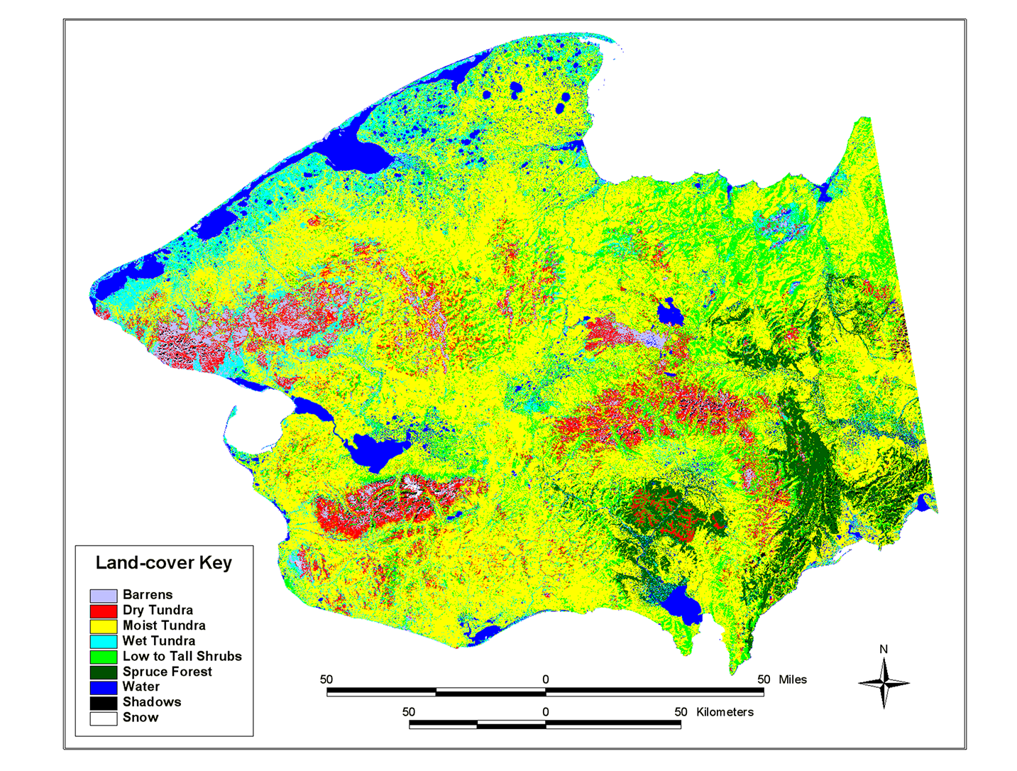
This land cover map of the Seward Peninsula is based on a classification of Multi-Spectral Scanner (MSS) data. The Landsat multiple scene mosaic was furnished by the USGS, EROS Data...
Source: Landsat MSS-derived land-cover map of the Seward Peninsula, Alaska
追加情報
| フィールド | 値 |
|---|---|
| 最終更新日 | 2019 / 12月 / 17, |
| メタデータ最終更新日時 | 2019 / 12月 / 17, |
| 作成日 | 2019 / 12月 / 17, |
| データ形式 | image/png |
| ライセンス | ライセンスが提示されていません |
| created | 6 年以上前 |
| format | PNG |
| has views | True |
| id | 395743ab-89e8-4cce-846a-681d5de118fe |
| last modified | 6 年以上前 |
| mimetype | image/png |
| on same domain | True |
| package id | a36fa90b-c940-40a6-96d8-c968665afb66 |
| position | 3 |
| revision id | c7d5ffb1-362e-4a09-a096-23e32f53301c |
| size | 1.3 MiB |
| state | active |
| url type | upload |