
Map Image
データセットの概要より
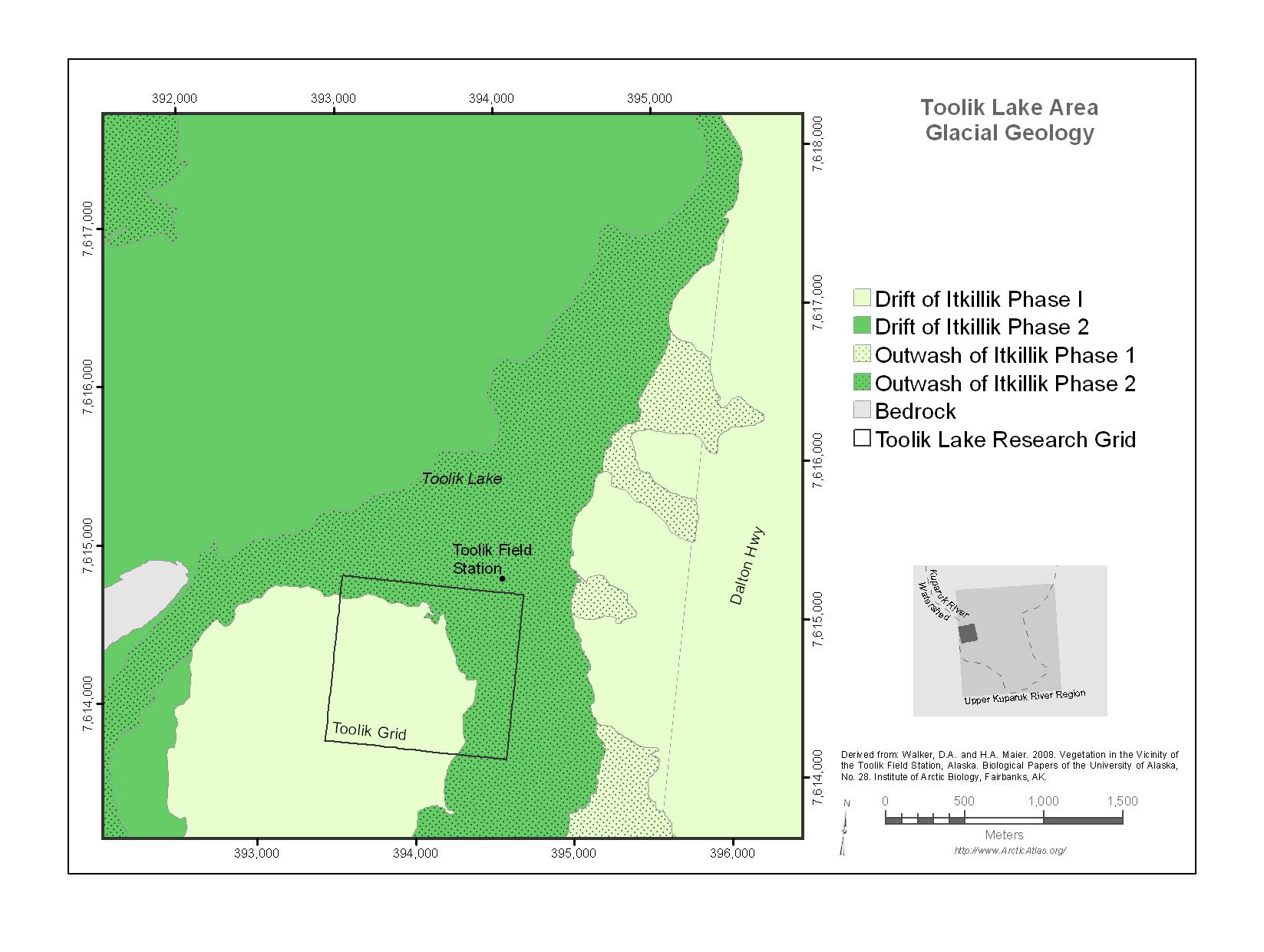
The map encloses a 20 km^2 area surrounding Toolik Lake that stretches from the Dalton Highway on the east to Jade Mountain on the west. It includes the Toolik Field Station, the old...
Source: Toolik Lake Area Glacial Geology
追加情報
| フィールド | 値 |
|---|---|
| 最終更新日 | 2019 / 12月 / 17, |
| メタデータ最終更新日時 | 2019 / 12月 / 17, |
| 作成日 | 2019 / 12月 / 17, |
| データ形式 | image/png |
| ライセンス | ライセンスが提示されていません |
| created | 6 年以上前 |
| format | PNG |
| has views | True |
| id | 034cb03e-e17a-4de7-be1e-1a8ae35cd453 |
| last modified | 6 年以上前 |
| mimetype | image/png |
| on same domain | True |
| package id | 64a24459-6fd1-4353-9288-eb076e171f91 |
| position | 1 |
| revision id | e00e7883-a130-41b8-ae44-b1acb49a5db8 |
| size | 86 KiB |
| state | active |
| url type | upload |