
aga_prudhoe_geobotancal_2014.jpg
Från sammanfattningen av detta dataset
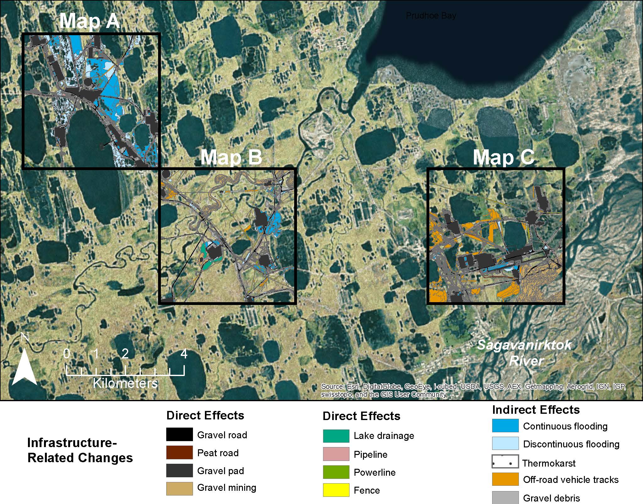
Map C of the historical infrastructure changes for the Prudhoe Bay Oilfield for 10 dates from the initial oil discovery in 1968–2011. Aerial photos taken in 1949 and 1968 were used to...
Mer information
| Fält | Värde |
|---|---|
| Data last updated | December 17, 2019 |
| Metadata last updated | December 17, 2019 |
| Skapad | December 17, 2019 |
| Format | image/jpeg |
| Licens | Licens ej angiven |
| created | mer än 5 år sedan |
| format | JPEG |
| has views | True |
| id | a85c5920-51ae-4ddb-b7e5-8e2955ab07ff |
| last modified | mer än 5 år sedan |
| mimetype | image/jpeg |
| on same domain | True |
| package id | 14121b28-77df-4681-ab96-884a55fb2daf |
| position | 4 |
| revision id | e826514e-26f7-4b83-a7c4-6173d1e6677e |
| size | 429,5 KiB |
| state | active |
| url type | upload |