
Map Image Preview
З опису набори даних
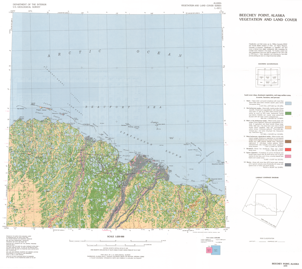
This report presents a Landsat-derived land cover classification of the Beechey Point, Alaska, 1:250,000-scale quadrangle with descriptions of the major vegetation units. Eight...
Джерело: Beechey Point Land Cover Classification: CRREL Report 87-5
Додаткова інформація
| Поле | Значення |
|---|---|
| Останнє оновлення даних | 17 Грудень 2019 |
| Останнє оновлення метаданих | 17 Грудень 2019 |
| Створено | 17 Грудень 2019 |
| Формат | image/png |
| Ліцензія | Не вказано ліцензію |
| created | більше 6 років назад |
| format | PNG |
| has views | True |
| id | 6d825f56-1e71-41a6-b9ac-6be0ed226541 |
| last modified | більше 6 років назад |
| mimetype | image/png |
| on same domain | True |
| package id | 98fcb47a-8a78-45e3-8f27-c6a907441759 |
| position | 1 |
| revision id | 51f14ed4-c026-43a3-86ef-f96cc854dbf7 |
| size | 1,1 MiB |
| state | active |
| url type | upload |