
Map Image
З опису набори даних
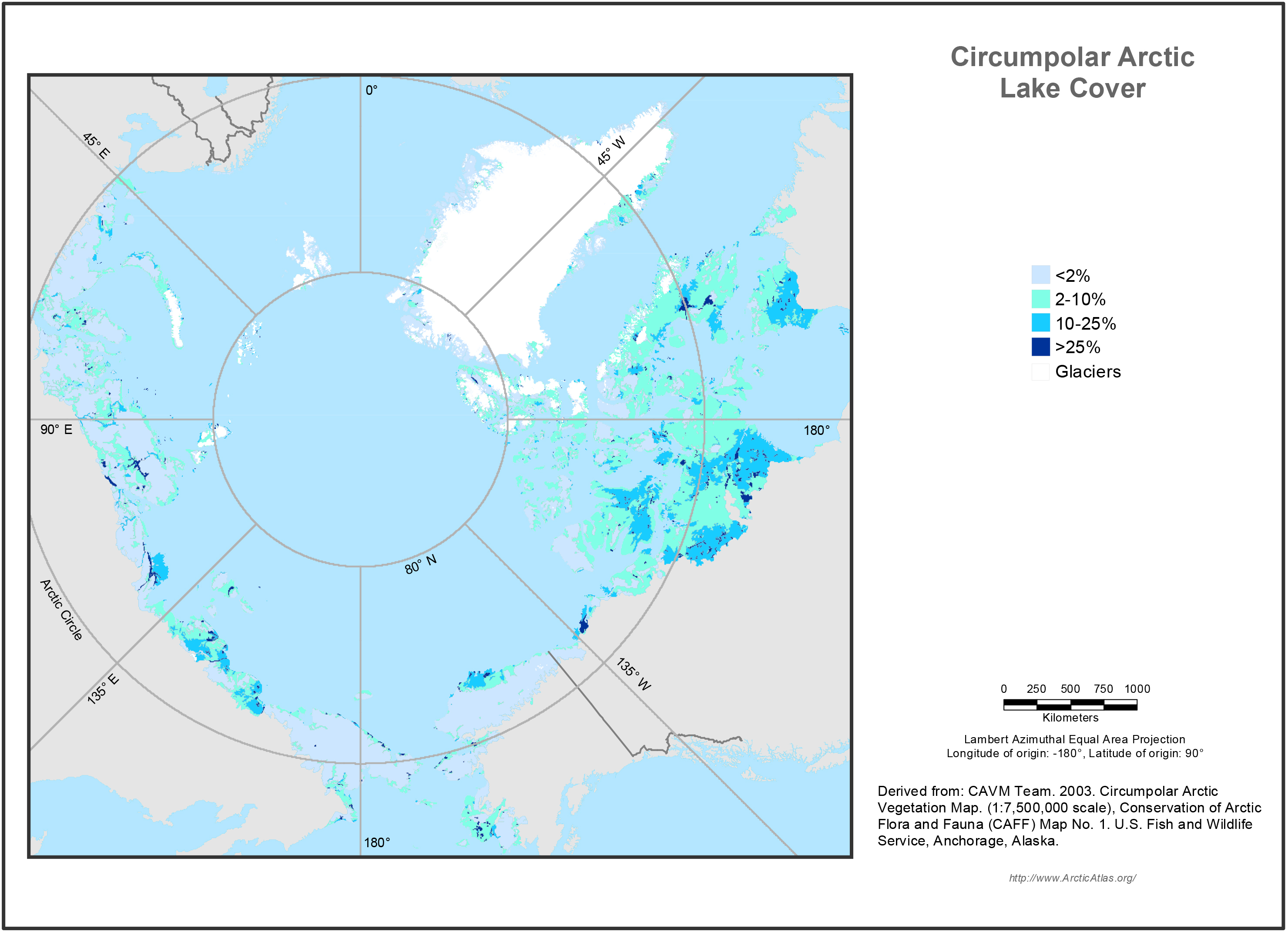
Lake cover strongly affects the reflectance of the land surface over large areas of the Arctic, and was useful for identifying extensive wetlands. Lake cover was based on the number of...
Джерело: Circumpolar Arctic Lake Cover Map
Додаткова інформація
| Поле | Значення |
|---|---|
| Останнє оновлення даних | 17 Грудень 2019 |
| Останнє оновлення метаданих | 17 Грудень 2019 |
| Створено | 17 Грудень 2019 |
| Формат | image/jpeg |
| Ліцензія | Не вказано ліцензію |
| created | більше 6 років назад |
| format | JPEG |
| has views | True |
| id | 1fdd89f4-036b-426b-9fff-bf8895ee9fa2 |
| last modified | більше 6 років назад |
| mimetype | image/jpeg |
| on same domain | True |
| package id | de6ab40d-5d0d-467c-bc06-a0be834240c0 |
| position | 1 |
| revision id | b740f080-5f53-473e-b3fe-acfa3e05c942 |
| size | 1,7 MiB |
| state | active |
| url type | upload |