
Screen Shot 2017-09-22 at 12.31.29 PM.jpg
З опису набори даних
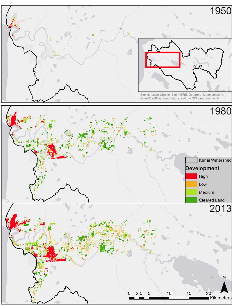
The expanding footprint of human development in the lower Kenai River watershed based on analysis of aerial photographs. Inset in top panel shows location within entire Kenai River...
Джерело: Human Development in the Lower Kenai River Watershed, 1950-2013 - Interactive Slider Graphic
Додаткова інформація
| Поле | Значення |
|---|---|
| Останнє оновлення даних | 17 Грудень 2019 |
| Останнє оновлення метаданих | 17 Грудень 2019 |
| Створено | 17 Грудень 2019 |
| Формат | image/jpeg |
| Ліцензія | License not specified |
| created | більше 6 років назад |
| format | JPEG |
| has views | True |
| id | a412456e-096c-4433-8020-e05af3daf4c2 |
| last modified | більше 6 років назад |
| mimetype | image/jpeg |
| on same domain | True |
| package id | 1786f5d9-d5bb-4f27-b480-f42595b6e6ed |
| position | 1 |
| revision id | e7a25e1c-825f-4b29-9099-d41d8c142a57 |
| size | 175,4 KiB |
| state | active |
| url type | upload |