
Map Image (C) Preview
来自数据集摘要
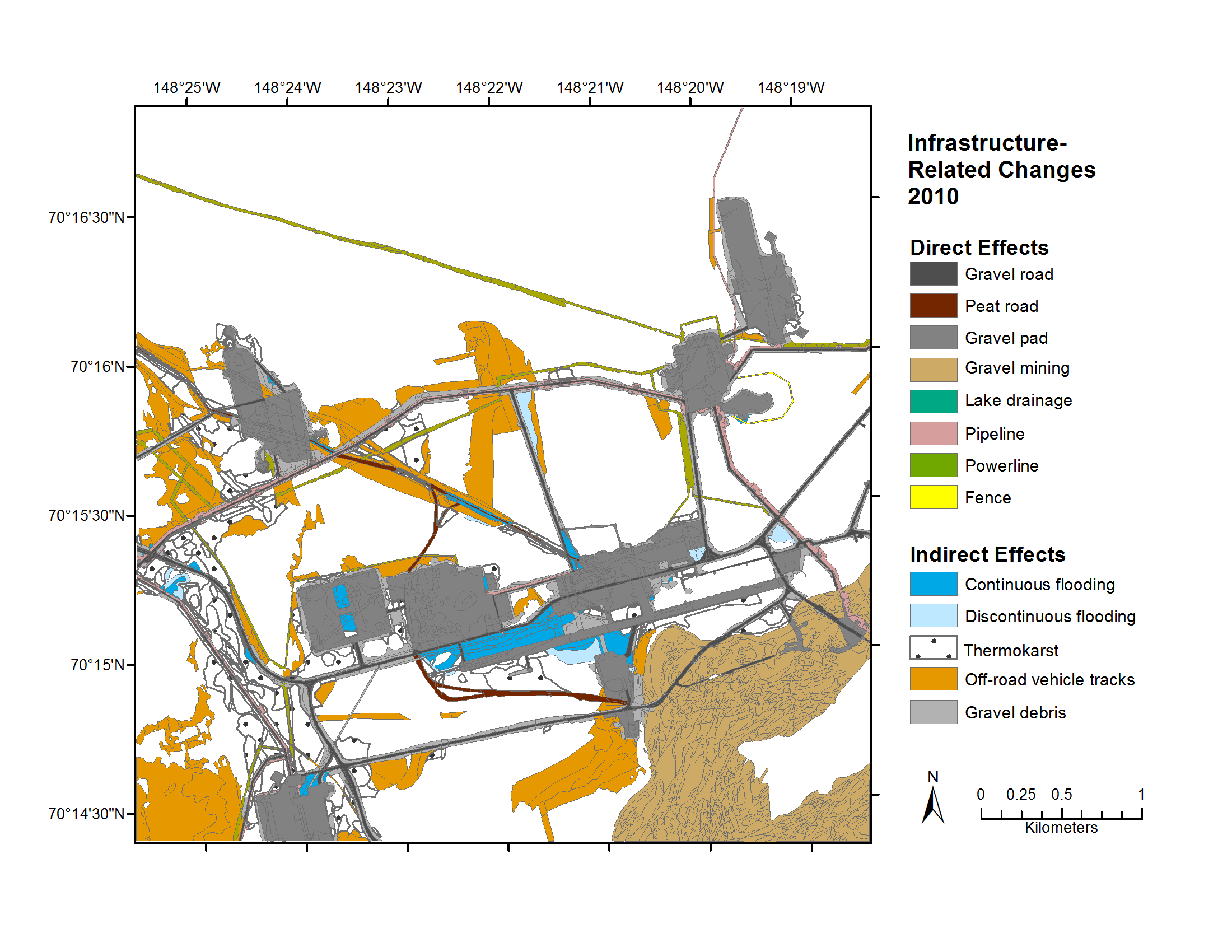
Map A of the historical infrastructure changes for the Prudhoe Bay Oilfield for 10 dates from the initial oil discovery in 1968–2011. Aerial photos taken in 1949 and 1968 were used to...
其他信息
| 域 | 价值 |
|---|---|
| Data last updated | 十二月 17, 2019 |
| Metadata last updated | 十二月 17, 2019 |
| 创建的 | 十二月 17, 2019 |
| 格式 | image/png |
| 授权 | 没有指定授权 |
| created | 6年前 |
| format | PNG |
| has views | True |
| id | 0fabec4a-99ff-441e-9952-12aefa44719e |
| last modified | 6年前 |
| mimetype | image/png |
| on same domain | True |
| package id | b87ec189-8224-46a3-b12b-cf2398994c57 |
| position | 9 |
| revision id | 42f2dd50-b0c5-41e9-af3e-5fbdf5a5f88b |
| size | 211.8 KiB |
| state | active |
| url type | upload |