
Map Image
根據資料集摘要
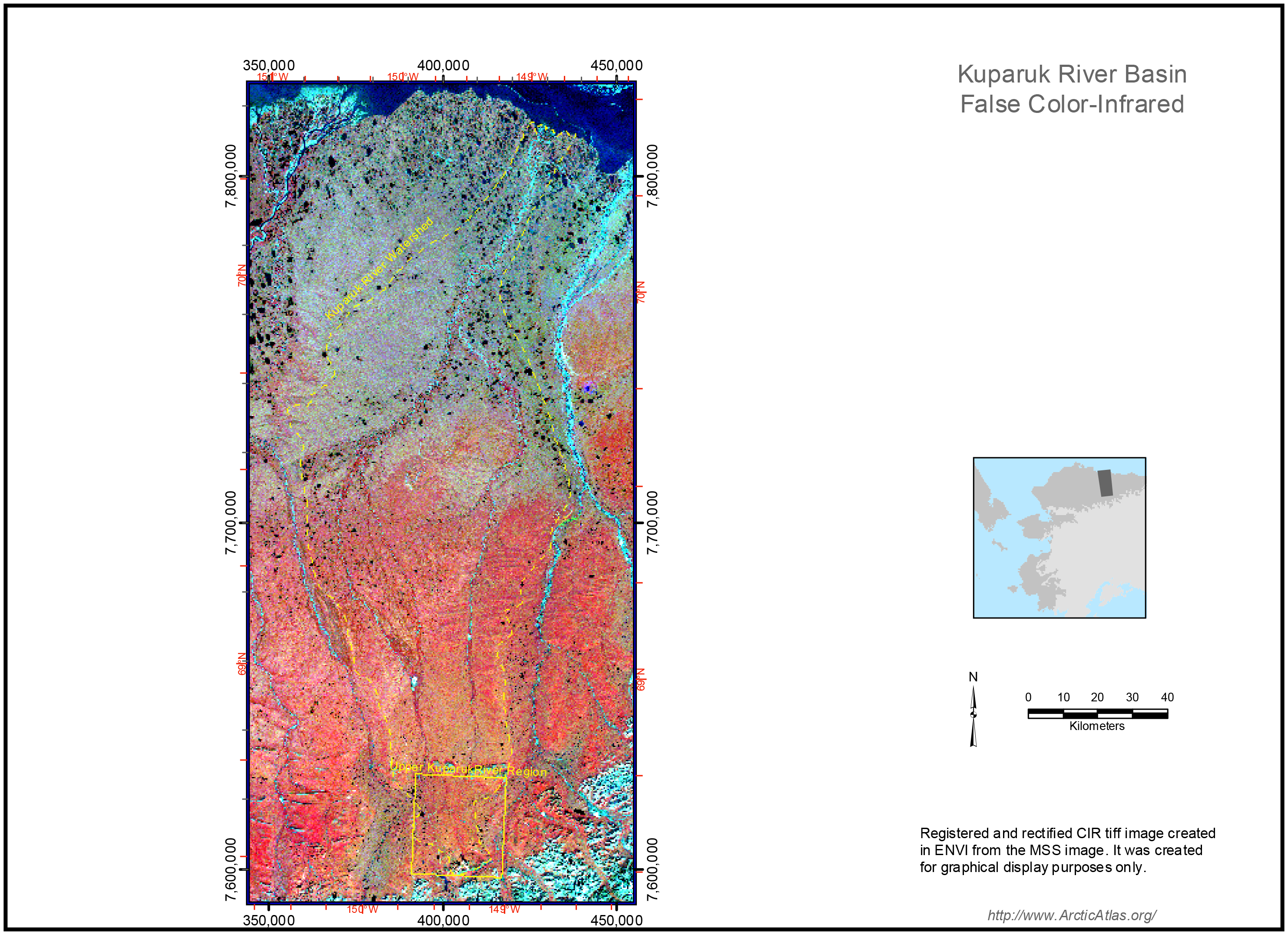
Kuparuk River Basin False Color-Infrared (CIR) image - Registered and rectified CIR image created in ENVI from the MSS image. It is a raster map (tiff), with 30-m pixel resolution. Back...
其他資訊
| 欄位 | 值 |
|---|---|
| 最後更新資料 | 十二月 17, 2019 |
| 最後更新的詮釋資料 | 十二月 17, 2019 |
| 建立 | 十二月 17, 2019 |
| 格式 | image/png |
| 授權 | 沒有可使用的許可 |
| created | 超過 6 年之前 |
| format | PNG |
| has views | True |
| id | 4edcc095-7b6a-45cb-aa88-447789f2354b |
| last modified | 超過 6 年之前 |
| mimetype | image/png |
| on same domain | True |
| package id | 0ccafc54-5ea6-4062-9bda-08f990e9cae6 |
| position | 1 |
| revision id | 90ff51bd-3d34-4df7-806d-dd010bd37696 |
| size | 2 MiB |
| state | active |
| url type | upload |