
Map Preview
根據資料集摘要
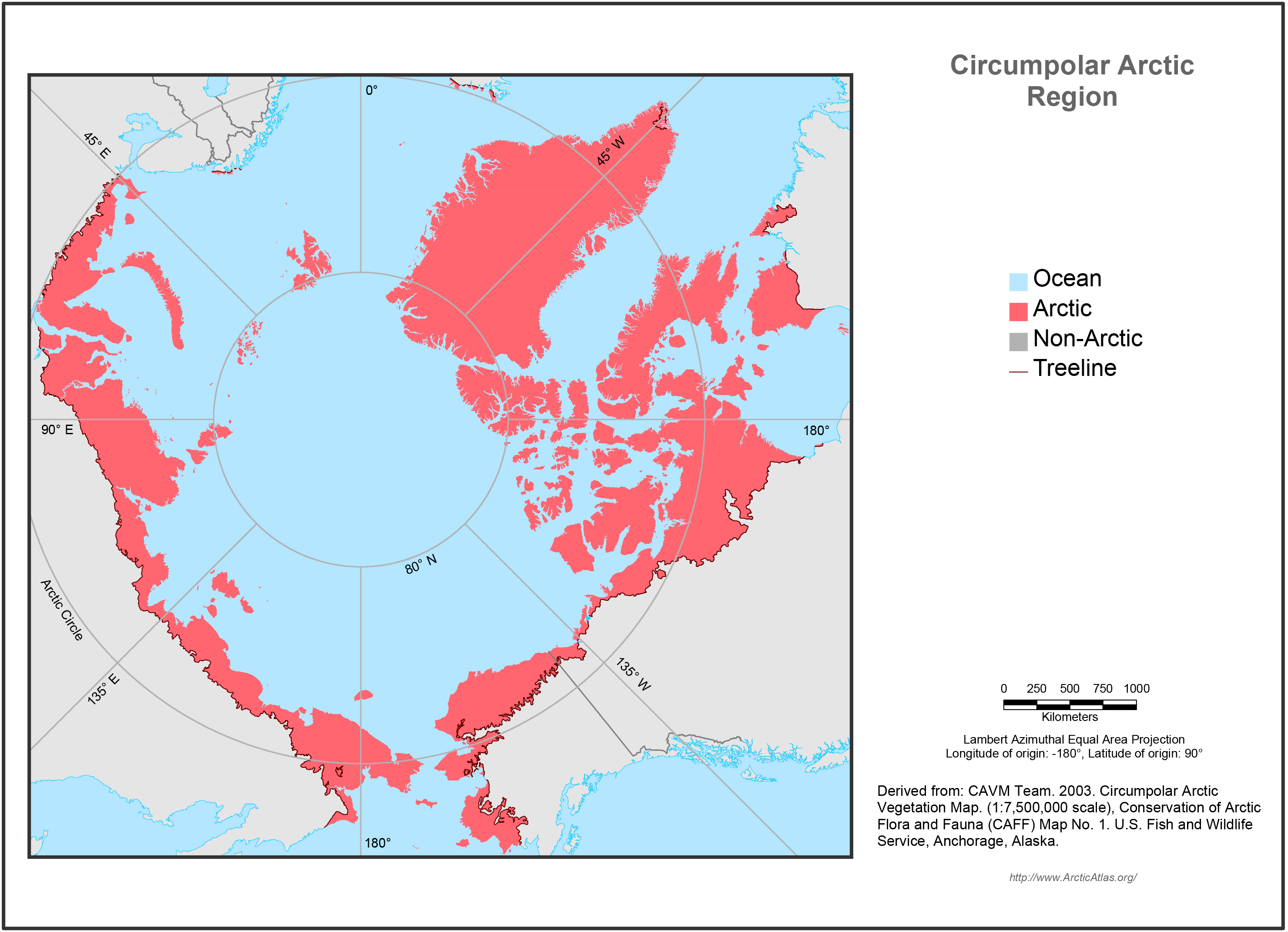
The map extent is the Arctic, defined as the Arctic Bioclimate Zone, the area of the Earth with tundra vegetation and an Arctic climate and Arctic flora. It excludes tundra regions that...
其他資訊
| 欄位 | 值 |
|---|---|
| 最後更新資料 | 十二月 17, 2019 |
| 最後更新的詮釋資料 | 十二月 17, 2019 |
| 建立 | 十二月 17, 2019 |
| 格式 | image/jpeg |
| 授權 | 沒有可使用的許可 |
| created | 超過 6 年之前 |
| format | JPEG |
| has views | True |
| id | 21b596f3-2819-4834-ac1e-8d47af95b70b |
| last modified | 超過 6 年之前 |
| mimetype | image/jpeg |
| on same domain | True |
| package id | b2d8d9e1-44a8-4edb-89cd-0780449d0ccf |
| position | 2 |
| revision id | 185acd5e-6bd2-4a04-a655-033c3ab3eb04 |
| size | 1.6 MiB |
| state | active |
| url type | upload |