
Map Image
根據資料集摘要
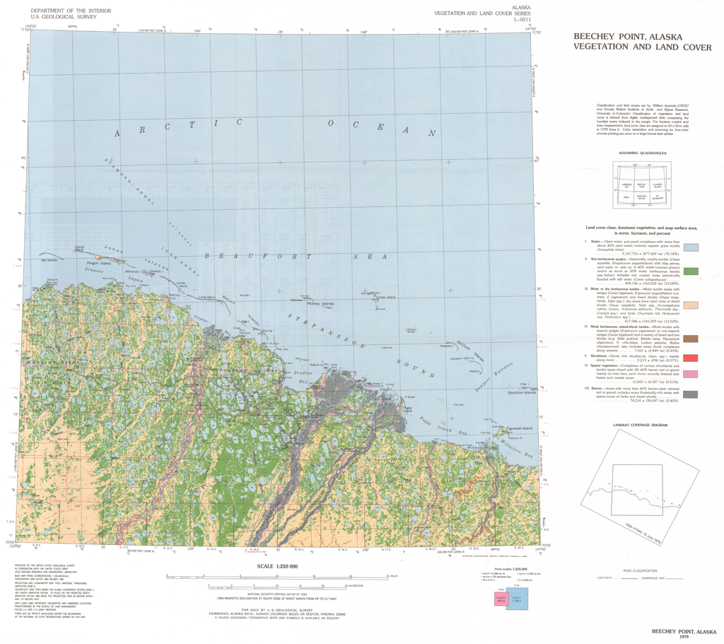
This report presents a Landsat-derived land cover classification of the Beechey Point, Alaska, 1:250,000-scale quadrangle with descriptions of the major vegetation units. Eight...
來源:Beechey Point Land Cover Classification: CRREL Report 87-5
其他資訊
| 欄位 | 值 |
|---|---|
| 最後更新資料 | 十二月 17, 2019 |
| 最後更新的詮釋資料 | 十二月 17, 2019 |
| 建立 | 十二月 17, 2019 |
| 格式 | image/png |
| 授權 | 沒有可使用的許可 |
| created | 超過 6 年之前 |
| format | PNG |
| has views | True |
| id | 9e57a197-a373-4bd7-adfb-8a04447a99c9 |
| last modified | 超過 6 年之前 |
| mimetype | image/png |
| on same domain | True |
| package id | 98fcb47a-8a78-45e3-8f27-c6a907441759 |
| position | 4 |
| revision id | e62b8497-878d-4cdc-9271-50600db339fb |
| size | 1.1 MiB |
| state | active |
| url type | upload |