
Map Image
根據資料集摘要
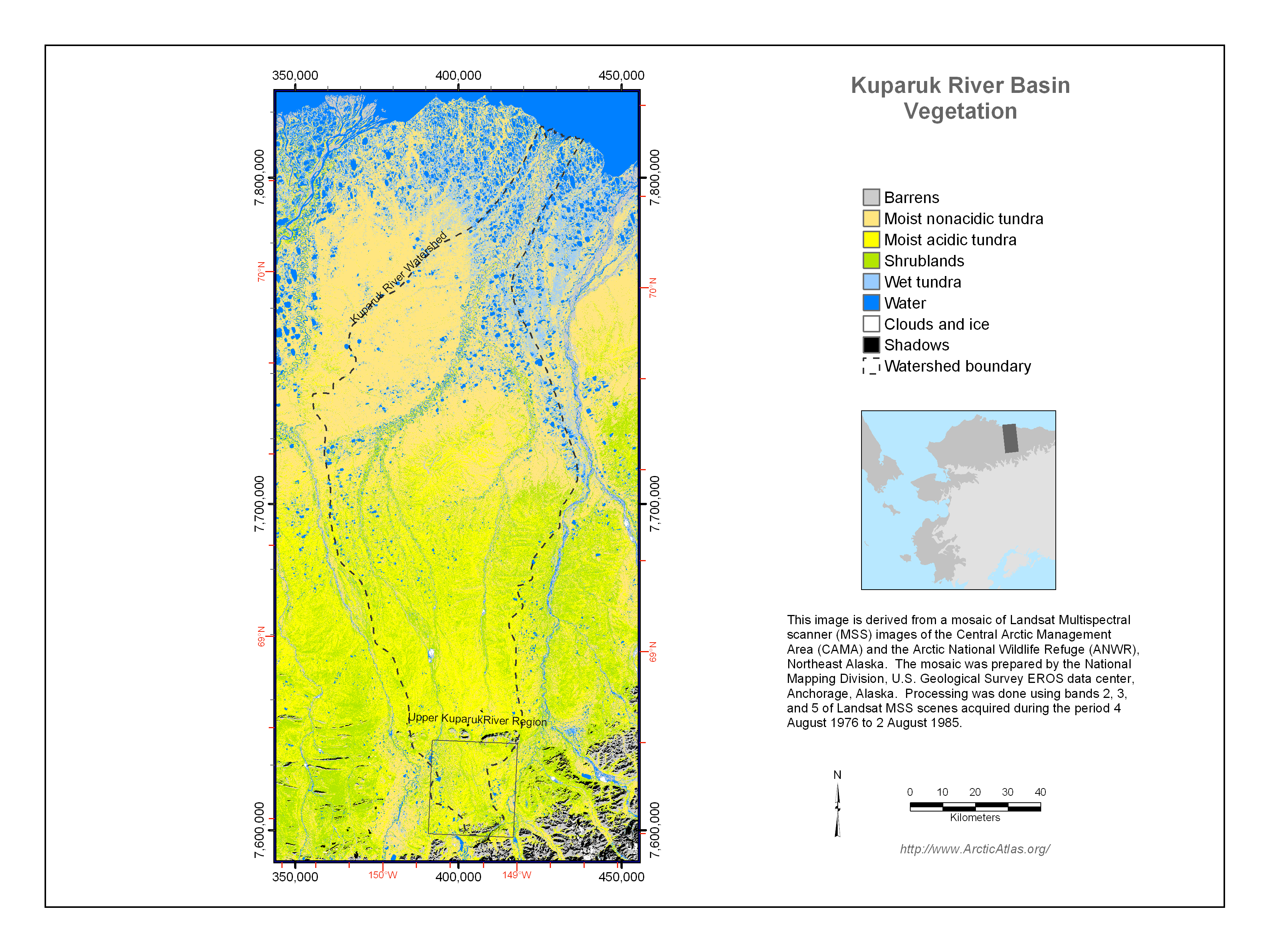
The vegetation of the Kuparuk River watershed was mapped for several US National Science Foundation projects, including the Arctic System Science Flux Study and the Long-Term Ecological...
其他資訊
| 欄位 | 值 |
|---|---|
| 最後更新資料 | 十二月 17, 2019 |
| 最後更新的詮釋資料 | 十二月 17, 2019 |
| 建立 | 十二月 17, 2019 |
| 格式 | image/png |
| 授權 | 沒有可使用的許可 |
| created | 超過 6 年之前 |
| format | PNG |
| has views | True |
| id | 7369e652-005e-480d-8b20-8da2c9da7188 |
| last modified | 超過 6 年之前 |
| mimetype | image/png |
| on same domain | True |
| package id | dca96ea1-f56f-41ad-8156-a76791670da8 |
| position | 4 |
| revision id | 375b40eb-8829-400a-8ab8-2c6eda102e47 |
| size | 1.1 MiB |
| state | active |
| url type | upload |