
Map Image Preview
根據資料集摘要
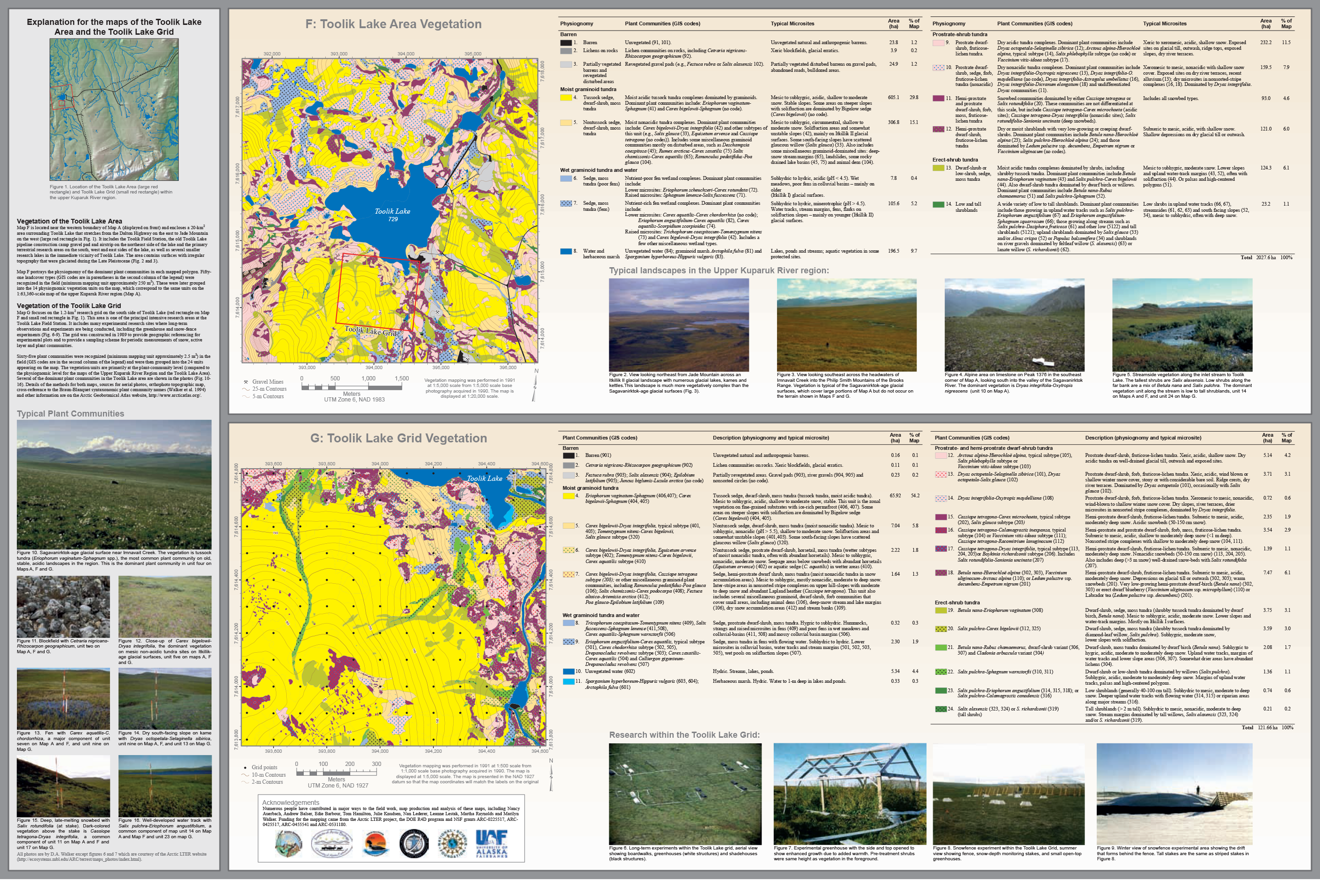
The Toolik Lake vegetation area is located near the western boundary of the Upper Kuparuk River region and encloses a 20-km^2 area surrounding Toolik Lake that stretches from the Dalton...
其他資訊
| 欄位 | 值 |
|---|---|
| 最後更新資料 | 十二月 17, 2019 |
| 最後更新的詮釋資料 | 十二月 17, 2019 |
| 建立 | 十二月 17, 2019 |
| 格式 | image/png |
| 授權 | 沒有可使用的許可 |
| created | 超過 6 年之前 |
| format | PNG |
| has views | True |
| id | 0e49b5f3-e34b-43ac-b032-2a3c7b9a82b2 |
| last modified | 超過 6 年之前 |
| mimetype | image/png |
| on same domain | True |
| package id | ce93a90d-c6f4-473d-aba2-f2966daed0bb |
| position | 4 |
| revision id | 129ed8ef-8dd8-4f96-87b4-47a9e71462c1 |
| size | 3.3 MiB |
| state | active |
| url type | upload |