I2E.png
Del resumen del conjunto de datos
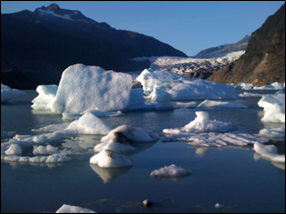
The Icefields to Estuaries map of the Southeast Alaska Coastal Module contains glaciers, estuaries, watershed boundaries, hydrology, sea surface temperatures, salinity, currents,...
Información adicional
| Campo | Valor |
|---|---|
| Última actualización de los datos | Diciembre 17, 2019 |
| Última actualización de los metadatos | Diciembre 17, 2019 |
| Creado | Diciembre 17, 2019 |
| Formato | image/png |
| Licencia | No se ha proporcionado una licencia |
| created | hace 6 años |
| format | PNG |
| has views | True |
| id | e07e7c26-ae6a-4ab8-ba26-0342f69c9393 |
| last modified | hace 6 años |
| mimetype | image/png |
| on same domain | True |
| package id | 0bcbede9-c9f2-4a83-a68a-fe7650ec46bb |
| position | 3 |
| revision id | ce9d1110-a65a-452c-9c22-f536555fe9c4 |
| size | 156,3 KiB |
| state | active |
| url type | upload |

