
Map Image
Dal riassunto del dataset
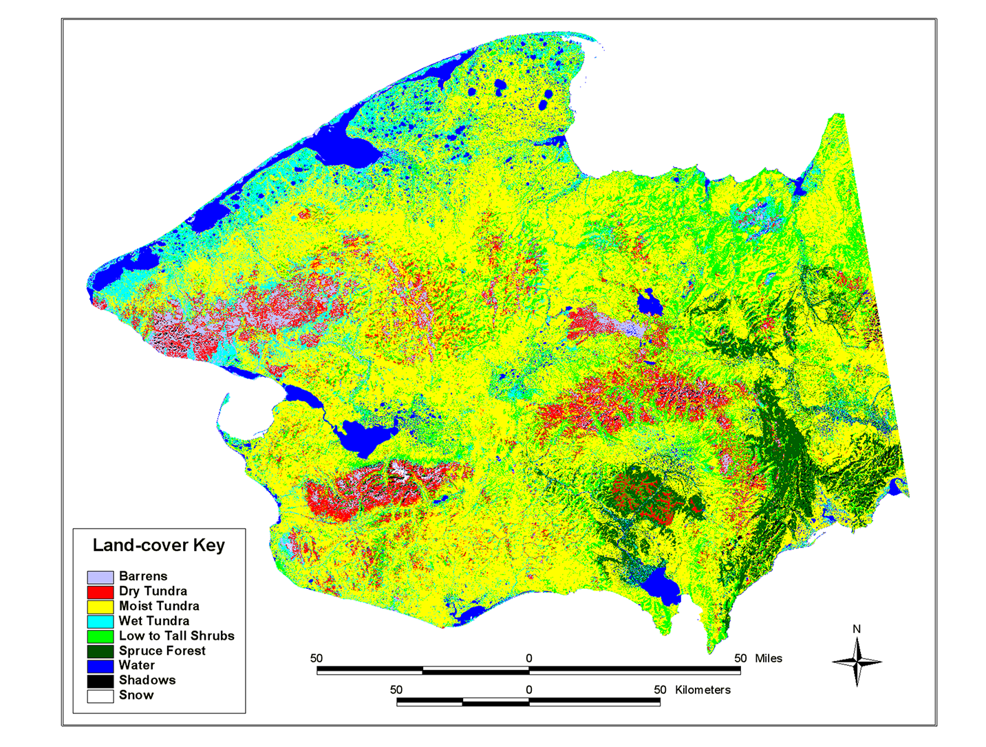
This land cover map of the Seward Peninsula is based on a classification of Multi-Spectral Scanner (MSS) data. The Landsat multiple scene mosaic was furnished by the USGS, EROS Data...
Sorgente: Landsat MSS-derived land-cover map of the Seward Peninsula, Alaska
Informazioni supplementari
| Campo | Valore |
|---|---|
| Data last updated | Dicembre 17, 2019 |
| Metadata last updated | Dicembre 17, 2019 |
| Creato | Dicembre 17, 2019 |
| Formato | image/png |
| Licenza | Nessuna licenza indicata |
| created | più di 6 anni fa |
| format | PNG |
| has views | True |
| id | 395743ab-89e8-4cce-846a-681d5de118fe |
| last modified | più di 6 anni fa |
| mimetype | image/png |
| on same domain | True |
| package id | a36fa90b-c940-40a6-96d8-c968665afb66 |
| position | 3 |
| revision id | c7d5ffb1-362e-4a09-a096-23e32f53301c |
| size | 1,3 MiB |
| state | active |
| url type | upload |