
marine.png
Dal riassunto del dataset
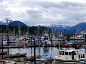
The Marine Resource Planning map of the Southeast Alaska Coastal Module contains vessel traffic, oil spill response layers, mariculture, ESI, earthquakes, spills, landslides, and other...
Informazioni supplementari
| Campo | Valore |
|---|---|
| Data last updated | Dicembre 17, 2019 |
| Metadata last updated | Dicembre 17, 2019 |
| Creato | Dicembre 17, 2019 |
| Formato | image/png |
| Licenza | Nessuna licenza indicata |
| created | più di 6 anni fa |
| format | PNG |
| has views | True |
| id | 9a53d897-b2e4-4c4c-bda2-08d99a809210 |
| last modified | più di 6 anni fa |
| mimetype | image/png |
| on same domain | True |
| package id | 456c08f2-3cc4-43c4-bc81-d22d10af6d25 |
| position | 3 |
| revision id | 6f63aca1-9b75-4ac6-a143-23a1ae6dcf1b |
| size | 136,7 KiB |
| state | active |
| url type | upload |