
aga_prudhoe_b_change_2010.jpg
データセットの概要より
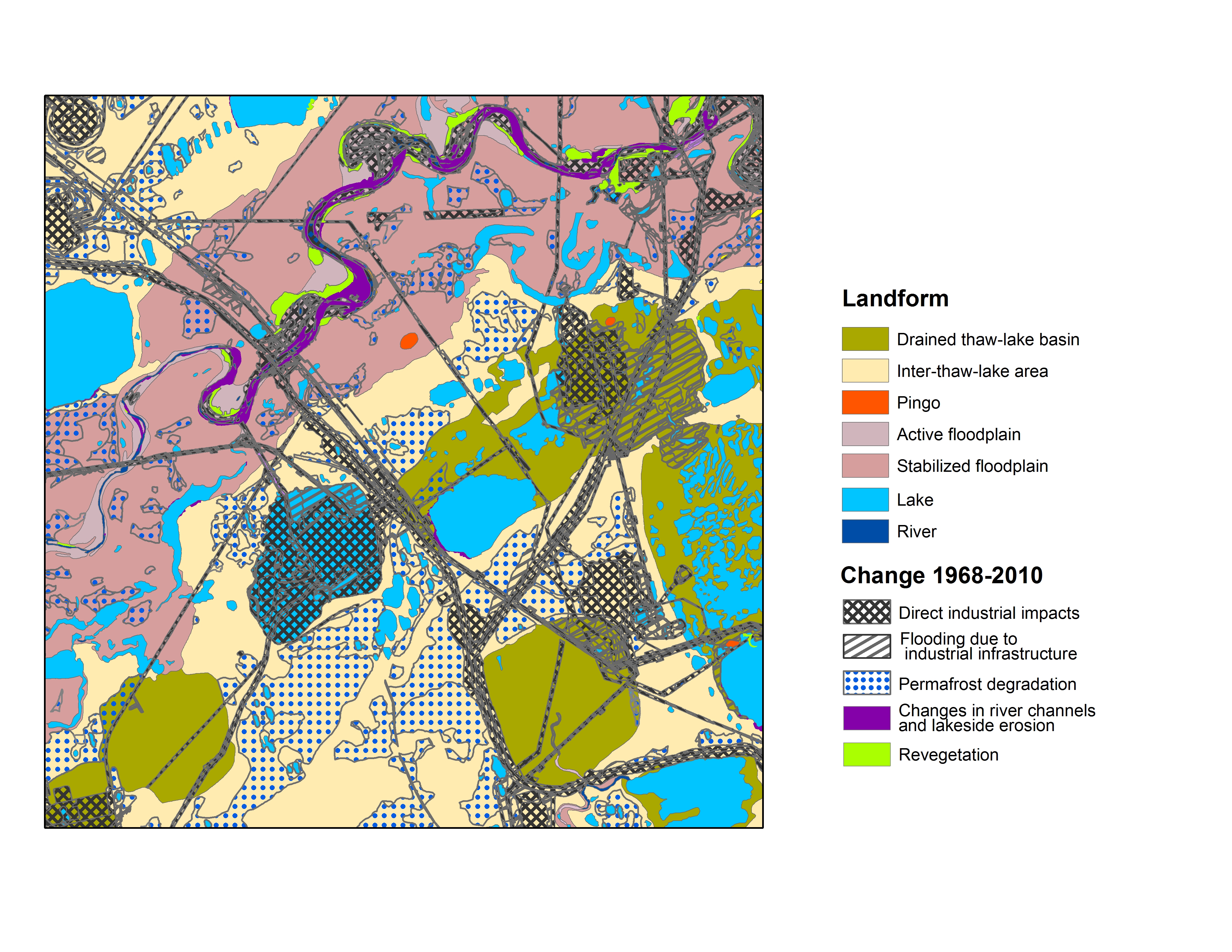
Map B of the historical infrastructure changes for the Prudhoe Bay Oilfield for 10 dates from the initial oil discovery in 1968–2011. Aerial photos taken in 1949 and 1968 were used to...
追加情報
| フィールド | 値 |
|---|---|
| 最終更新日 | 2019 / 12月 / 17, |
| メタデータ最終更新日時 | 2019 / 12月 / 17, |
| 作成日 | 2019 / 12月 / 17, |
| データ形式 | image/jpeg |
| ライセンス | ライセンスが提示されていません |
| created | 6 年以上前 |
| format | JPEG |
| has views | True |
| id | afb78480-d1cd-49bd-9c88-8da56e561203 |
| last modified | 6 年以上前 |
| mimetype | image/jpeg |
| on same domain | True |
| package id | 0aa5a30f-cfb7-4401-9284-636f5c1e824c |
| position | 1 |
| revision id | e29b62b2-1d5e-4cee-b00c-c71342856fdb |
| size | 5.6 MiB |
| state | active |
| url type | upload |