
Map Image Preview
来自数据集摘要
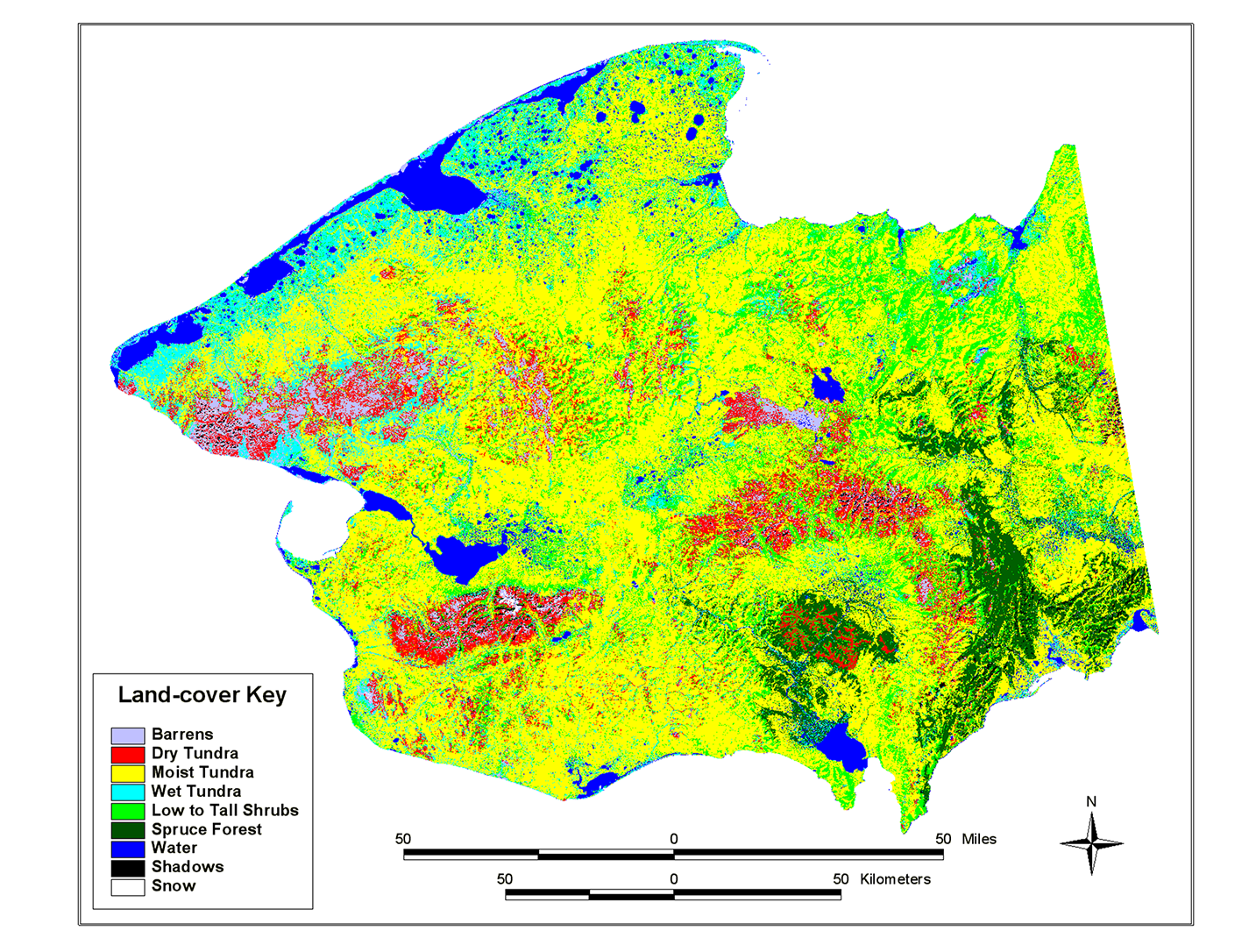
This land cover map of the Seward Peninsula is based on a classification of Multi-Spectral Scanner (MSS) data. The Landsat multiple scene mosaic was furnished by the USGS, EROS Data...
来源: Landsat MSS-derived land-cover map of the Seward Peninsula, Alaska
其他信息
| 域 | 价值 |
|---|---|
| Data last updated | 十二月 17, 2019 |
| Metadata last updated | 十二月 17, 2019 |
| 创建的 | 十二月 17, 2019 |
| 格式 | image/png |
| 授权 | 没有指定授权 |
| created | 6年前 |
| format | PNG |
| has views | True |
| id | e4910e36-38e0-4f11-8f41-95d25b14bda7 |
| last modified | 6年前 |
| mimetype | image/png |
| on same domain | True |
| package id | a36fa90b-c940-40a6-96d8-c968665afb66 |
| position | 2 |
| revision id | e31632be-99e8-4746-a719-0b6ee4faa720 |
| size | 1.3 MiB |
| state | active |
| url type | upload |