
Map Image Preview
根據資料集摘要
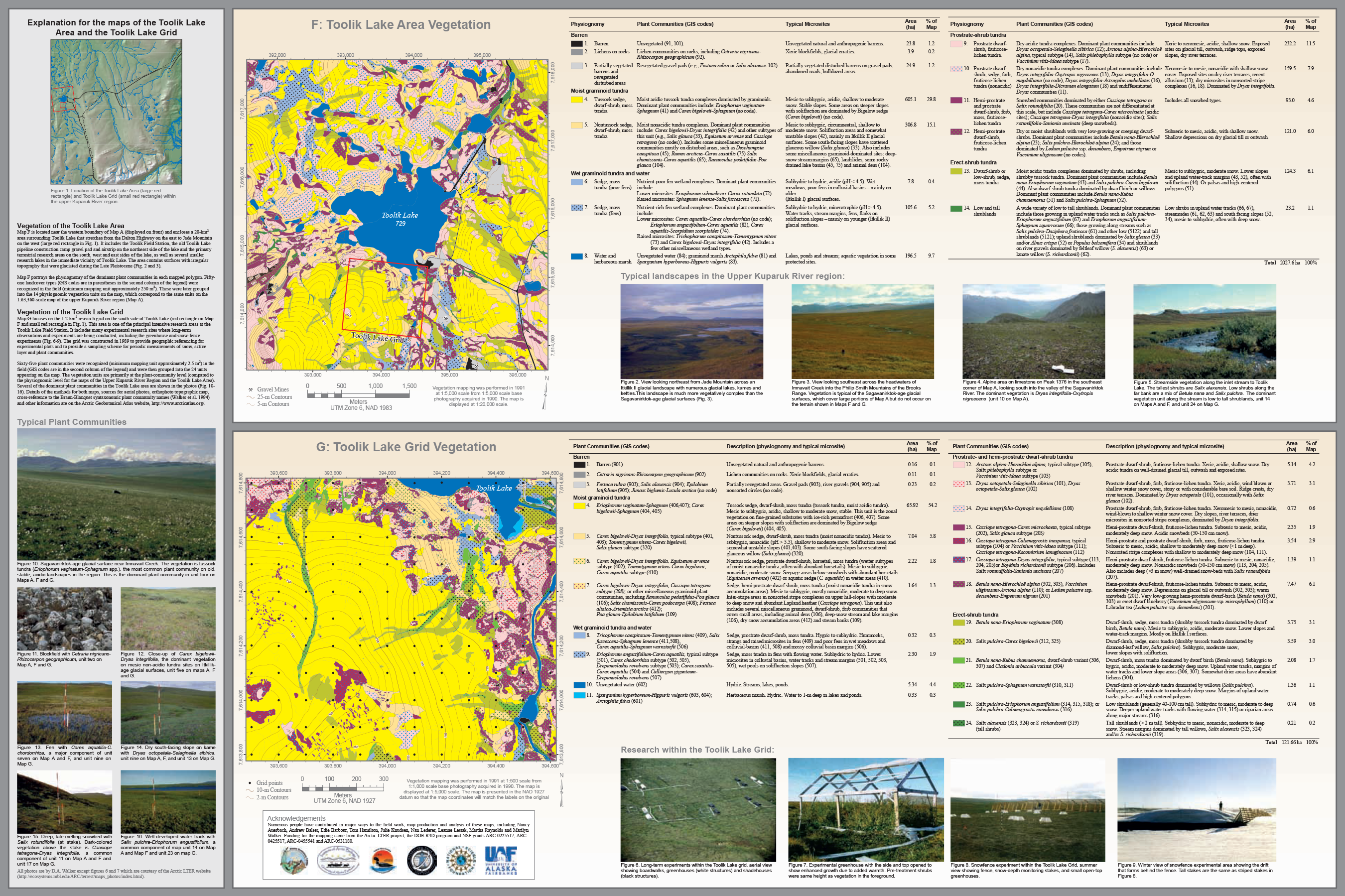
The Toolik Lake grid map focuses on the 1.2-km2 research grid on the south side of Toolik Lake. This area is one of the principal intensive research areas at the Toolik Lake Field...
其他資訊
| 欄位 | 值 |
|---|---|
| 最後更新資料 | 十二月 17, 2019 |
| 最後更新的詮釋資料 | 十二月 17, 2019 |
| 建立 | 十二月 17, 2019 |
| 格式 | image/png |
| 授權 | 沒有可使用的許可 |
| created | 超過 6 年之前 |
| format | PNG |
| has views | True |
| id | 1030c049-a1f8-4d86-a2ce-bf8d94ba1977 |
| last modified | 超過 6 年之前 |
| mimetype | image/png |
| on same domain | True |
| package id | 78661c27-44b7-46c0-abad-57f16bf0a4b2 |
| position | 1 |
| revision id | 6307b634-913a-40ec-9645-843f66596a49 |
| size | 3.3 MiB |
| state | active |
| url type | upload |